| JMII |
| (Weather Master) |
| Tue Sep 27 2022 05:17 PM |
| Attachment |

|
|
|
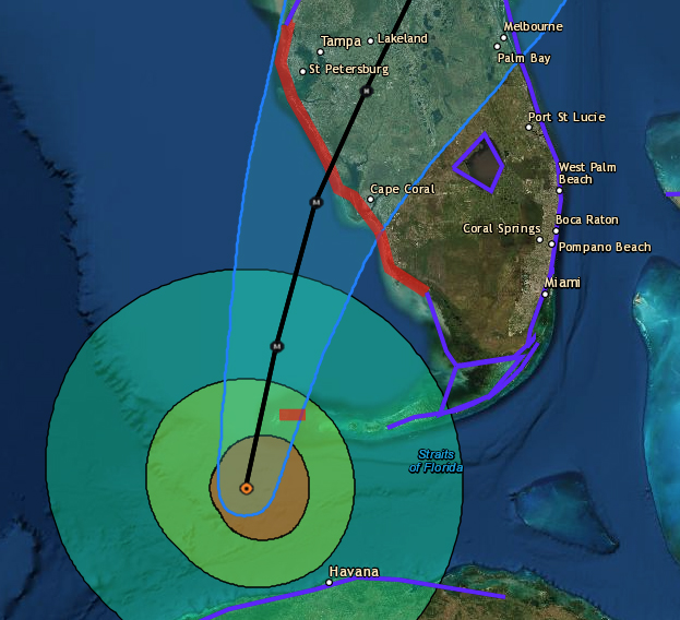
Yep its been tracking NNE all day, in the last few frames on radar it jogged more N. Looking at the water vapor loop the front is strong and digging in across AL and MS. Ian about to run into a wall thus I don't see it making it to Tampa given the overall environmental conditions. The NHC has moved the track S again. The track was N of Sarasota County at 5AM, 12 hours later at 5PM its S of Sarasota County. I hate referencing Charley but fear the focus on Tampa might be overstated... again. In 24 hours this thing will be on top of Ft Myers.
BTW the interactive NHC map is great especially with the wind radii overlay...
Ian will go right over Dry Tortugas so we should get some good data then.