| cieldumort |
| (Moderator) |
| Sat Aug 19 2023 04:01 AM |

|
|
|
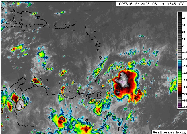
A small but robust tropical wave centered a few hundred miles east-southeast of the Lesser Antilles has been showing increasing signs of organization. This feature has just been Invest tagged 90L, and despite low initial NHC odds for development (0%/30%), this feature may surprise on the upside.
While models are flickering warm/cool on this feature, conditions for development across the Caribbean (including the "Graveyard" eastern Caribbean) are actually quite anomalously favorable. The operational Tropical Cyclone Formation Probability Product shows the Caribbean overall to be running more than twice as conducive for development as normal this time of year, with the bulk of that coming from the eastern Caribbean - with that favorable swath also edging well into the Main Development Region east of the Lesser Antilles.
Given 90L's close proximity to land, the fact that the Invest will soon be landlocked, and the anomalously favorable environment it finds itself in, we are starting a Lounge on this Invest at this time.
Small disturbances often don't make it, but those that do, often overperform.
Track is presently W-WNW at 10 to 15 mph. Should 90L develop and intensify, as is possible, a more poleward track may commence.
Invest 90L has been upgraded to Tropical Storm Franklin at 5PM 8/20 and the title is updated accordingly. - Ciel