| cieldumort |
| (Moderator) |
| Sat Aug 26 2023 09:54 AM |

|
|
|
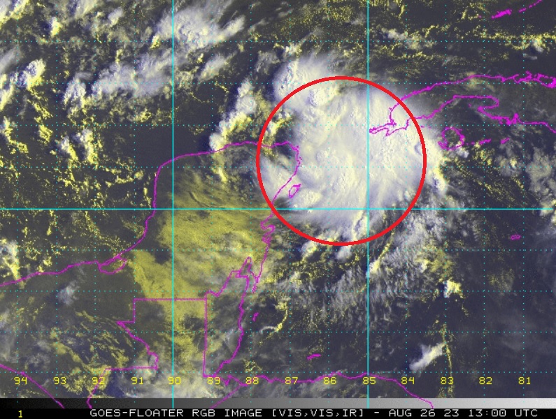
First light helps confirm overnight ship and buoy reports that a small well-defined low-level vortext most likely exists under increasingly better-organized deep convection, and a tropical cyclone may already exist or presently be forming, somewhere about 21N 86W as of 26/1300z in the image above.
Smaller T.C.s can be especially challenging for models to identify and forecast, and at this point I would take any models that call for a weaker tropical cyclone in the Gulf with a grain of salt. With the especially favorable SSTs, things could ramp up quite a bit more.
Unfortunately for all, scatterometer has missed 93L for almost 24 hours, and recon won't be out until tomorrow.
There is possibly already a small core of winds to tropical storm force in the system.