| cieldumort |
| (Moderator) |
| Tue Sep 05 2023 05:16 PM |

|
|
|
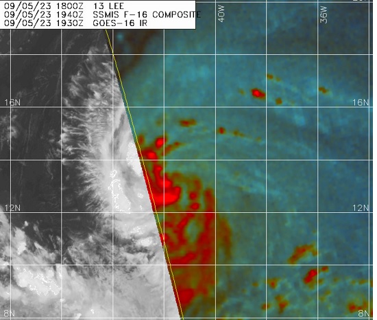
Lee's structure is incredibly solid for a newly named tropical storm, and there are reasons to suspect that maximum sustained winds may already be higher than the 5PM NHC advisory.
This morning, Lee (then TD 13) was analyzed to be located near 12.5N 40.2W, with the forecast position 12 hours from then at 12.8N 42.1W, or far more west than north.
As of the 5PM Advisory, Lee is now analyzed to be located at 13.2N 41.8W, the center having tracked 0.7N and 1.6W over the course of six hours, compared to the 0.3N 1.9W anticipated over twelve hours. This is a bit faster and more poleward than NHC first forecast, or reflects a center readjustment/hop.
While it is possible that Lee adjusts southerly back to the Adv 1 forecast, that is unlikely. Nonetheless, as per the 5PM NHC Discussion, " a mid-level ridge over the central Atlantic likely to persist to the north of the storm. This ridge should provide a steady steering current, with a general west-northwestward course expected through the weekend with some reduction in forward speed."