| cieldumort |
| (Moderator) |
| Sat Oct 28 2023 01:25 PM |

|
|
|
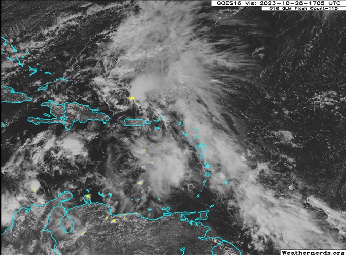
An area of low pressure formed this morning north of Puerto Rico and has persisted for several hours with an elongated low-level circulation and an abundance of showers and a few thunderstorms extending from a portion of its eastern semicircle with feeders extending deep into the the tropical Atlantic. This feature has now been Invest tagged, 96L, and despite tepid model support for development, given its current state and location close to land we are starting a Lounge on this feature at this time.
96L consists of an elongated area of closed or mostly closed surface low pressure and associated trof. Shear over the system is modest, however possibly higher than analyzed by CIMSS earlier today, given that the present track is generally west with winds in the mid to upper levels daggering out of the southwest.
Model support for development into a tropical or subtropical cyclone has been hit-or-miss, but generally suggests that there is a window over the course of the next several days for 96L to become a depression or weak storm, with locations in the W Atlantic, including but not limited to the Bahamas and Bermuda, in its potential path.