| cieldumort |
| (Moderator) |
| Wed Nov 15 2023 11:49 PM |

|
|
|
A hybrid area of low pressure, a break-off from the non-tropical low traveling across the northern Gulf of Mexico, is packing quite a lot of punch tonight, and although conditions for transition into a more traditional (Nameable) sub-tropical, say nothing of tropical, storm are limited, this area of low pressure does possess some features often found in both non-tropical and tropical cyclones.
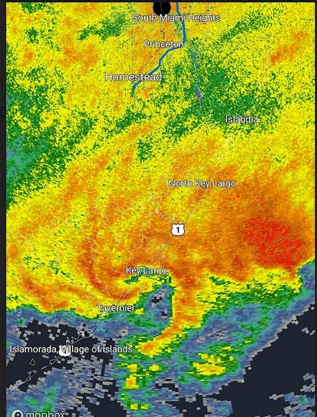
Given the intensity of the storm and proximity to land, we are starting a lounge on this feature now despite very low (10%) official NHC odds of classification.
This developing low pressure system has already been producing sustained surface winds well into tropical storm force, and has something of an "eye-like" feature presently located over Key Largo. Models suggest that there is a slight chance that this could develop into something that resembles a hybrid hurricane as it tracks northeast along or nearly along the Gulf Stream, en route towards the coastal northeastern US, Canada, or out to sea.
This feature does not yet have an Invest tag, but could be assigned one, and the title will be updated accordingly as warranted.