| cieldumort |
| (Moderator) |
| Fri Jun 28 2024 06:06 PM |

|
|
|
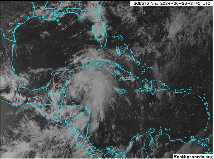
Above: Invest 94L at 2145z today. Image cr. Weathernerds.org
A convectively active tropical wave we have been watching in the Caribbean this week is now entering an increasingly less hostile region for development from the northwestern Caribbean to likely into the Bay of Campeche in the southwestern Gulf of Mexico by Sunday.
As conditions look increasingly favorable for development, and given its impressive moisture fetch and potential do drop significant rains over areas that recently had a bunch and do not want or need much more so soon regardless of development, we are now starting a Lounge on this feature.
As of this post, NHC odds are still in the low end at 30%, but this could easily prove conservative.
Recon has found that the area of low pressure in the Bay of Campeche we have been watching, Invest tagged 94L, has become a tropical cyclone, and the title has been updated accordingly. 6/30/24 4PM. Named Chris with the 10PM CDT NHC Advisory
Ciel
| Psyber |
| (Storm Tracker) |
| Fri Jun 28 2024 08:58 PM |

|
|
|
The European looks to keep it south before it develops in the southern Gulf of Mexico when it sneaks over the Yucatan. Hopefully, it stays weak as a rainmaker for Mexico.
| OrlandoDan |
| (Weather Master) |
| Sun Jun 30 2024 03:42 PM |

|
|
|
The Models have no grip on 94L yet. Let's monitor his resolution in another 24 hours
| cieldumort |
| (Moderator) |
| Sun Jun 30 2024 07:08 PM |
|
|
|
|
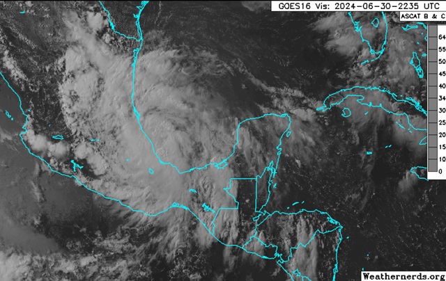
Above: Tropical Cyclone Three Visible June 30, 2024 2235z
Image credit: Weathernerds.org
Three has been intermittently producing winds to tropical storm force for the better part of its time over water for the past 24 hours or so. Although recon initially found an elongated closed low, while they were in there today, THREE became sufficiently organized to be classified a Depression.
With winds intermittently at or above 34 knots and its improving structure, the cyclone is likely to be named soon. The next name on the list is Chris.
Future-Chris probably does not have much time left over water, but just enough time to make for a significant flooding risk once again in eastern Mexico. Dissipation over the mountains by Tuesday or Wednesday is likely, and this is shown in most modeling.