| cieldumort |
| (Moderator) |
| Sat Jun 15 2024 07:40 PM |

|
|
|

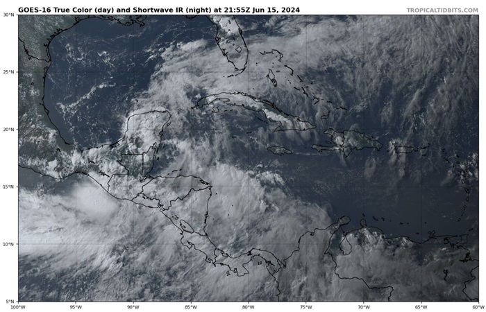
Above: Parent Central American Gyre June 15, 2024 2155z Image cr. Tropical Tidbits
Central American Gyre has once again become prominent in the region and its relative strength may complicate the ability of would-be-Invest-91L-in-the-Bay-of-Campeche to become a tropical cyclone, or should it do so, possibly have its track bent back towards extreme southern Mexico and central America contrary to most model runs.
CAG-born TCs are notoriously challenging to predict, and alternatively expected disturbance Invest 91L could even begin in the NW Caribbean, or even further north around Texas. There also remains an outside chance of TC genesis over the extreme East Pac that then crosses over into the W Atlantic, and even still no 91L at all (while least likely outcome).
Lots in play and "91L"'s initial location, interaction with parent CAG as well as other CAG vorts and even possible other TCs will have a ton of influence on its ultimate organization and track. Unsurprisingly, model consensus today appears to be breaking down some. It might not be until early next week that there is clarity. Meanwhile, Central America, southern/eastern Mexico, Texas and Louisiana are all likely to see greater or lesser impacts, with flooding rains the greatest risk over all.