| cieldumort |
| (Moderator) |
| Fri Jun 28 2024 06:06 PM |

|
|
|

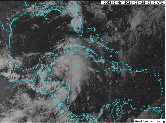
Above: Invest 94L at 2145z today. Image cr. Weathernerds.org
A convectively active tropical wave we have been watching in the Caribbean this week is now entering an increasingly less hostile region for development from the northwestern Caribbean to likely into the Bay of Campeche in the southwestern Gulf of Mexico by Sunday.
As conditions look increasingly favorable for development, and given its impressive moisture fetch and potential do drop significant rains over areas that recently had a bunch and do not want or need much more so soon regardless of development, we are now starting a Lounge on this feature.
As of this post, NHC odds are still in the low end at 30%, but this could easily prove conservative.
Recon has found that the area of low pressure in the Bay of Campeche we have been watching, Invest tagged 94L, has become a tropical cyclone, and the title has been updated accordingly. 6/30/24 4PM. Named Chris with the 10PM CDT NHC Advisory
Ciel