| cieldumort |
| (Moderator) |
| Sat Jun 29 2024 12:02 PM |

|
|
|
Something else to consider when comparing 2024 to prior years and looking for best analogs...
As of the June 29, 2024 11AM Advisory, the updated NHC intensity forecast explicitly forecasts Rapid Intensification and brings Beryl up to Major (Cat 3+) before it even reaches the Windwards. For the time of year, this is unprecedented.
Just looking at hurricanes passing within 100 miles of Barbados this early in a season, Dr. Philip Klotzbach notes: "Only 2 hurricanes on record (since 1851) have been within 100 miles of Barbados prior to 1 August: Emily (2005) and Elsa (2021)"
Taking a look at the intensities and tracks of our two only analogs for this event:
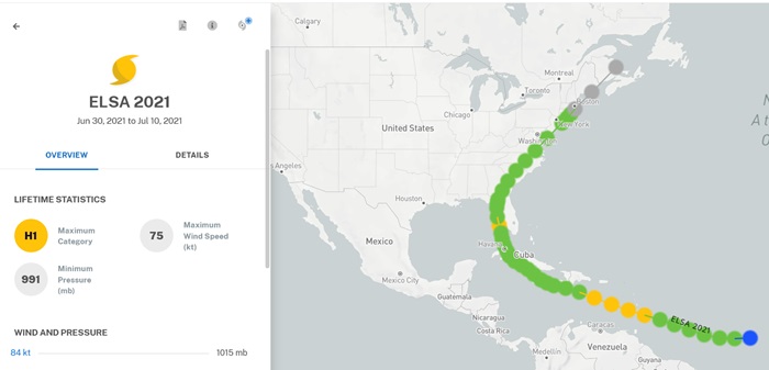
Above: Elsa (2021) passed through the Windwards as a Cat 1
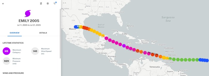
Above: Emily (2005) passed through the Windwards as a Cat 1