| cieldumort |
| (Moderator) |
| Tue Jul 30 2024 02:51 AM |

|
|
|
Further along in the 7 day outlook now, and the case for development is looking more compelling.
Models overall continue to favor the large wave becoming the dominant player here, leaving whatever portion of the southwestern area of disturbed weather that it doesn't devour too weak to amount to anything, with that feature's remains heading westward while south of the Greater Antilles.
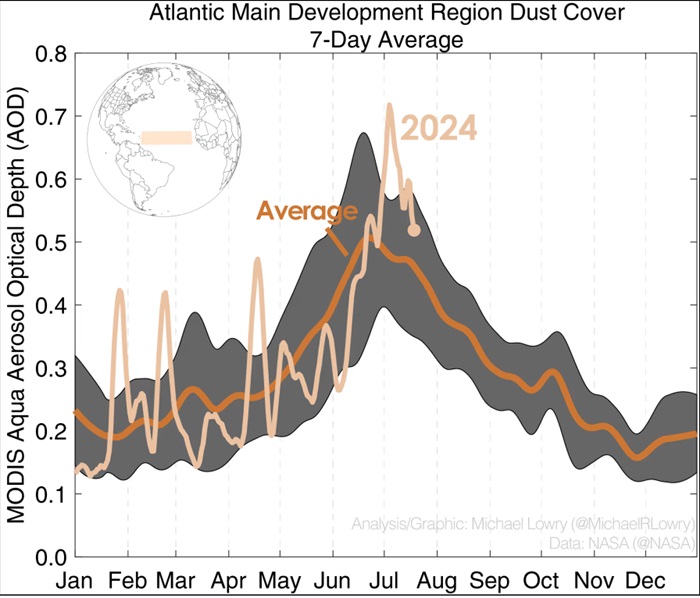
With SAL coming back down from record high levels (see image below), along with continued moistening of the low levels, breaking the cap eventually becomes likely in a forecast low shear environment atop record warm SSTs, and the 30/0z runs have strongly flipped back to development. Of interest, there is now a greater spread in potential track for even a stronger TS or hurricane, with the operational GFS delaying tropical cyclogenesis until this is in the NE GOM around August 6 and then sending a robust TC west towards a roughly Houston, TX landfall August 9.
This far out and with a system that isn't even Invest tagged, pure lounge speculation for landfall location/s and intensities, but it seems more likely than not that CONUS will be impacted, either directly or indirectly.

Above: Atlantic MDR dust coverage 7-day average credit: Michael Lowry