| cieldumort |
| (Moderator) |
| Fri Aug 09 2024 02:15 AM |

|
|
|
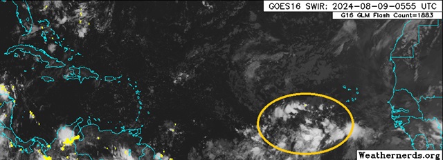
Modeling continues to point to improving background conditions for development as we head towards the climatological peak, and a tropical wave located a few hundred miles west-southwest of the Cabo Verdes increasingly looks likely to become our next Invest and potentially also named storm.
Steering currents favor a track that would take this system, developed or not, towards the Greater Antilles and Bahamas, then depending on how well formed it is as well as how much high pressure to its north is built in, may ultimately pose a threat to the CONUS and/or Bermuda and/or Canada. Despite the fact that there is nothing here more than a wave at this time, given that models nearly unanimously develop this feature and suggest it poses a threat to land, we are starting a Lounge at this time.
NHC odds for development as of this post are 0% within 48 hours and 50% within 7 days.
As noted, this wave is not yet Invest-tagged, but any status changes will be updated to the title as warranted.
As of 2024-08-10-0Z this wave is now being tracked as an Invest (98L) and the title has been updated accordingly
Ciel