| cieldumort |
| (Moderator) |
| Thu Sep 05 2024 11:07 AM |

|
|
|
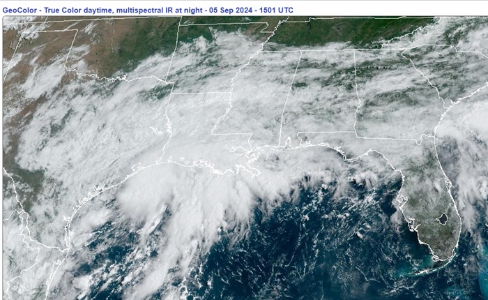
An elongated area of low pressure we have been watching for several days in the northwestern Gulf has pretty much freed itself of frontal association and continues tightening up this morning, and it appears to be closed off or just about closed off. With abundant moisture to work with and a window of low to moderate shear, this system may become a tropical depression or storm prior to being impinged upon by an approaching front. Regardless of development, conditions very similar to a wet tropical depression or even storm are likely to be on the rise across the region.
This feature is not yet Invest-tagged by NHC but could soon be.
More details to come.
This feature has just been Invest-tagged, 90L, and the title has been updated accordingly.
Synoptic Time Latitude Longitude Intensity
2024-09-05 18:00 28.0 -95.1 25
-Ciel