| cieldumort |
| (Moderator) |
| Sat Sep 07 2024 09:17 PM |

|
|
|
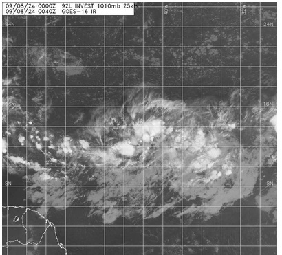
The Tropical Low in the Central Atlantic MDR has been Invest tagged tonight, 92L, and vort-centric model runs will be coming soon. With recon flying multiple rounds into the SW Gulf's 91L during the day on Sunday and with some time before this system could affect land, we shouldn't expect to see any missions into it until early next week or so, unless it recurves. Early guidance suggests that a track more west-northwest for a few days is most likely however, and interests in the Antilles may want to begin paying close attention.
NHC 7-day odds are now up to 50% tonight and this could still be conservative.