| cieldumort |
| (Moderator) |
| Mon Sep 09 2024 03:19 PM |

|
|
|
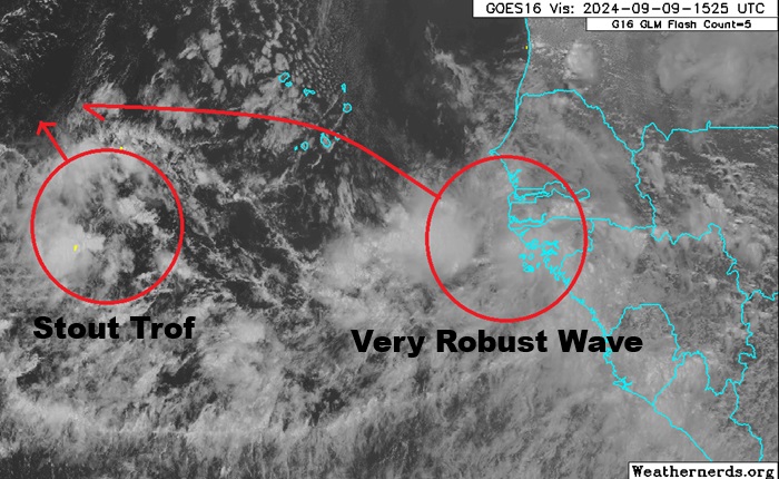
To add more clarity and context to the Trof in the far eastern Atlantic that is now up to 70% NHC development odds (within 7 days).
The NHC forecast, as do many models, expects the very robust wave now rolling off of western Africa to track wnw faster than the trof further west does, and for it to grab it and develop together. This is very possible, but also given how robust both are already, it is somewhat possible each develops on their own, with the trof less likely to become a fish spinner in that case, and the wave more likely to hook north prior to getting very far west. Should the two merge in order to develop, modeling shows a number of possible future solutions that are either fish spinny or potentially sneaking further west.