| cieldumort |
| (Moderator) |
| Thu Sep 12 2024 11:23 AM |

|
|
|

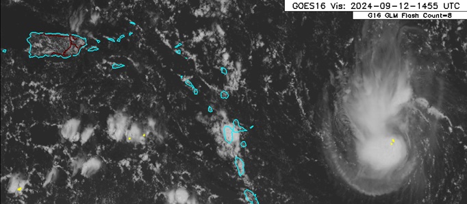
A small, vigorous low pressure area that has been tracking west out of the central tropical Atlantic, has been firing off showers and thunderstorms off and on despite nearby dry air and some light to moderate shear.
This low continues to over-perform the global models, which by and large had forecast it to fall apart or nearly so by now. The globals struggle with small systems, especially those way out in the Atlantic where we have less observations.
Given that this low has already been a borderline tropical cyclone, is looking better today and now approaching the Leeward Islands, we are starting a lounge on this feature today.
NHC odds have varied from 10% to 20% for the past few days, and this could be conservative. It is possible that the system already could meet the requirements to be classified, but given its small size, we have had few usable microwave passes to see all that is going on under the hood, and of course no recon yet.
More details to come