| cieldumort |
| (Moderator) |
| Fri Sep 20 2024 06:00 PM |

|
|
|
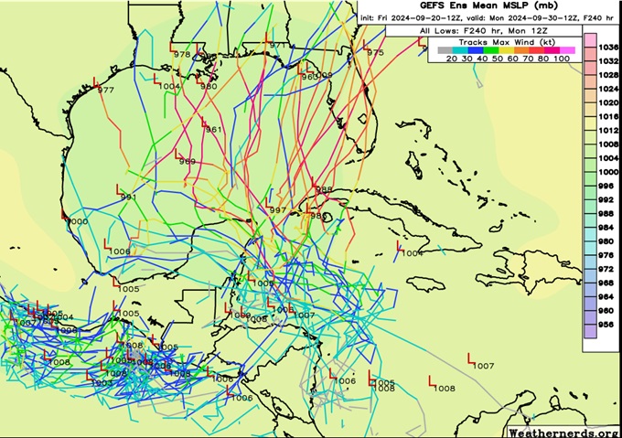
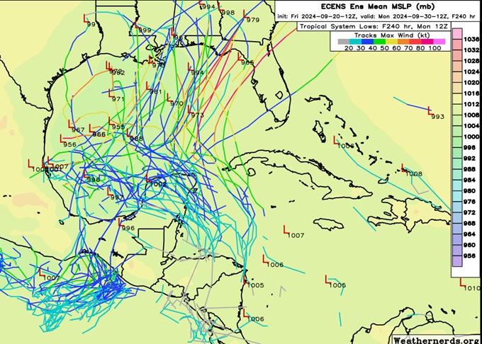
Today's 12z GFS and ECMWF ensembles are somewhat similar to yesterday's with the GEFS favoring earlier and more easterly development and subsequent stronger TCs that trend into the north to northeastern Gulf, and the ECENS development still a bit more delayed with a bias towards the northern to western Gulf. But, there is also arguably more of a shifting of the ECMWF ensembles towards the GFS members and not the other way around.
9/20/12z GFS members

9/20/12z ECMWF members

It is my personal read of the layout that should there be TC genesis out of this, which I would place at about 90% odds within 7 days (presently 50% NHC), it will most likely occur along or east of the eastern coasts of Central America and/or the Yucatán, possibly as far north as the Yucatán channel region, whereas the ECMWF still advertises several solutions, including the operationals, developing a TC in the southwestern Gulf.
Just where TCG occurs is likely to have an outsized influence on future track and intensity.