| cieldumort |
| (Moderator) |
| Mon Sep 23 2024 02:20 AM |

|
|
|
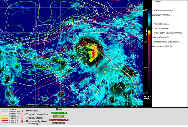
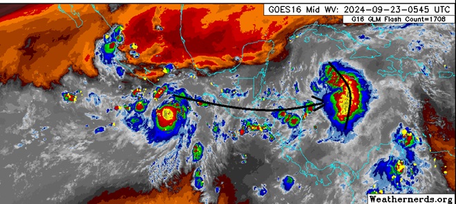
There is arguably a little more westerly shear than analyzed by CIMSS impinging on 97L tonight. This shear may indeed be getting enhanced from the outflow of now Tropical Storm John, which by many measures, could already be a 40-50 knot storm.
What using standard IR imagery might look like the "outer center" of 97L is really nothing more than a line of thunderstorms associated with what is probably its mid-level low, that has actually been getting bowed out towards the east.
Nonetheless, this near-term impediment may not last. East Pac Tropical Storm John looks like it could end up staying far enough west to have only minimal, temporary and/or transient negative impacts on 97L's future intensity. Ideally we will get recon passes into both systems later today or at latest tomorrow (Tuesday) and have a much clearer picture of this interaction.