| cieldumort |
| (Moderator) |
| Thu Sep 26 2024 02:01 PM |

|
|
|

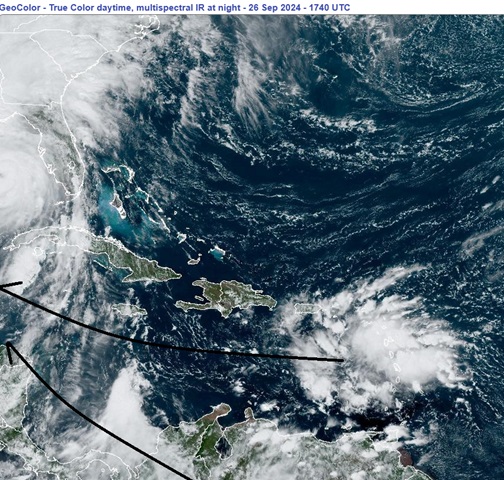
A wave now entering the Caribbean is likely to help pull up an area of spin over extreme northwestern South America this coming weekend, and once combined, a robust low could develop in the western Caribbean early to middle next week. Models are increasingly warming up to developing this low into a tropical cyclone, and NHC has just included this possibility in the afternoon Tropical Weather Update.
Given the strength of the signal from modeling and the fact that the basin is presently under favorable conditions for TC genesis, we are starting a lounge on this modeled tropical cyclone at this time. This feature does not yet have an Invest number, but may very well be assigned one by early next week, and we will update the title of this Lounge at that time, as warranted.
More details to come
As of 12PM CDT Friday October 4, the area of interest we have been tracking is now primarily located in the western Gulf of Mexico. The wave is now in the process of merging with some cross-over energy from former East Pac TD 11 (from Invest 96E), with increasing model support for significant development, and an Invest tag in the western Gulf could be coming as soon as later today or Saturday, and the title will be updated as warranted.
An Invest tag is coming on this feature. Invest 92L as of 0z 10-5-24
2024-10-05 00:00 22.0 -95.5 25
This system is now Milton as of 12:25PM CDT Saturday Oct 5
Ciel