| cieldumort |
| (Moderator) |
| Wed Oct 09 2024 10:06 AM |

|
|
|
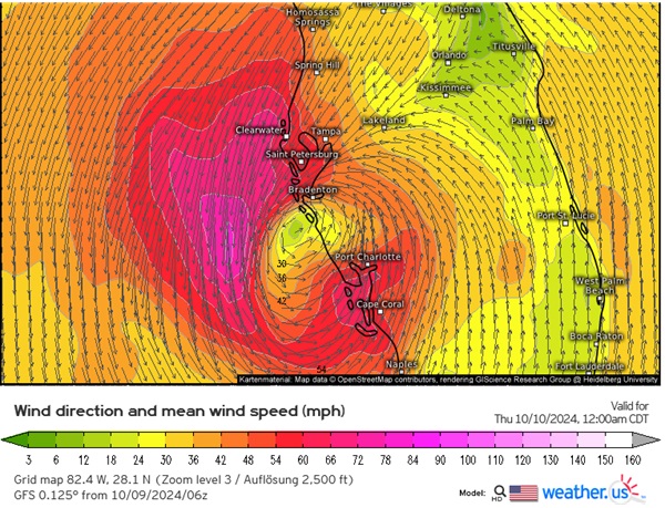
A close-up of surface wind speed and direction forecast with the 06z GFS would mean the greatest threat of very damaging to catastrophic surge most likely sets up between Naples and Sarasota, should this forecast hold exactly as advertised. Slight adjustments or even a wobble to the left could easily put Bradenton to Tampa back in play for the worst.
