| cieldumort |
| (Moderator) |
| Wed Oct 09 2024 01:50 PM |

|
|
|
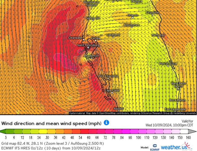
Today's 12z ECMWF Hi-Res Surface wind direction and speed valid for 11PM EDT tonight.
This model's 12z run advertises that the greatest threat for very dangerous to catastrophic storm surge could set up between Naples and Tampa Bay. Maximum sustained surface winds indicated by this model are likely understated by one or two categories as it is a global and not a hurricane model. Based on this model run, even a very slight track or wobble to the left of its guidance could put all of the Tampa region back at risk for the greatest surge threat.