| cieldumort |
| (Moderator) |
| Thu Oct 24 2024 12:20 PM |

|
|
|
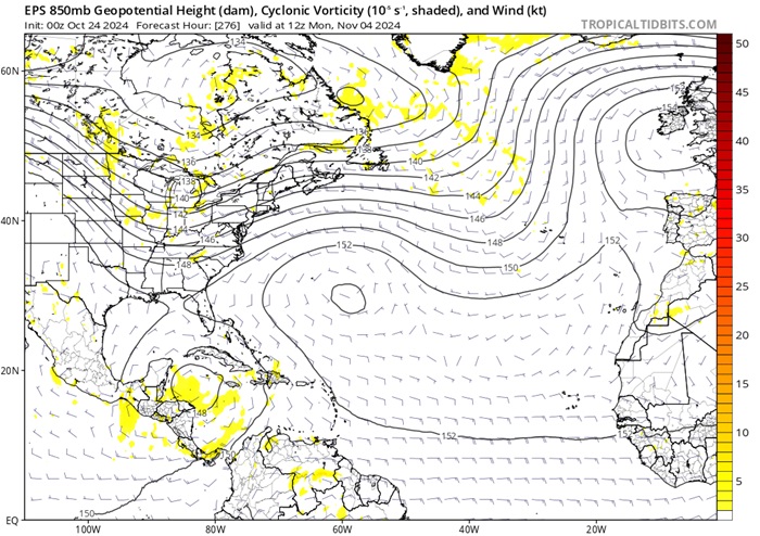
In the EPS model run shown below (image courtesy Tropical Tidbits), an approaching large scale trof crossing the CONUS around the time the forecast calls for an area of low pressure (possibly a TC) to exist in the Caribbean would favor pulling up whatever is there to the north or northeast.

Above: EPS* 850mb level forecast initialized 10-24-0z and valid for 11-04-12z
*ECMWF model's Ensemble Prediction System (Singular vectors and an ensemble of data assimilations).