| cieldumort |
| (Moderator) |
| Fri Nov 08 2024 12:03 PM |

|
|
|
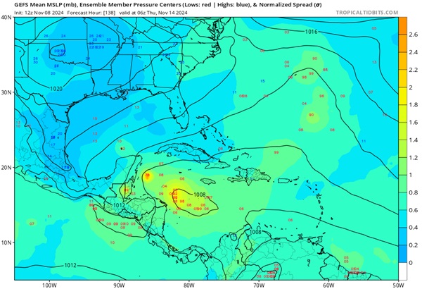
Models and ensemble members are increasingly warming up to the idea that a broad area of low pressure will form in the central to western Caribbean or across Central America later this coming weekend or next week, and out of this region a tropical cyclone could develop as soon as early next week to around the middle of the month. Generally, operational and ensemble member runs suggest about a 40% chance of TC genesis in this region, which would immediately be landlocked, and as such, we are starting a Lounge on this modeled feature.


An area of enhanced showers and thunderstorms associated with one of the approaching tropical waves set to interact with the developing broad area of low pressure in the Caribbean is continuing to show more early indications of TCG potential and is likely to become the center of focus for the next Invest tag to be assigned. The title will be updated accordingly.
2024-11-11 20z
The area of interest we are tracking has just been Invest tagged 99L and the title has been updated accordingly.
2024-11-12-18z
Potential Tropical Cyclone Nineteen
4:00 PM EST Wed Nov 13
Location: 16.2°N 79.0°W
Moving: W at 6 mph
Min pressure: 1007 mb
Max sustained: 30 mph
Sara 11-14-24 1PM CDT
Ciel