| cieldumort |
| (Moderator) |
| Sat Jun 14 2025 01:26 PM |

|
|
|

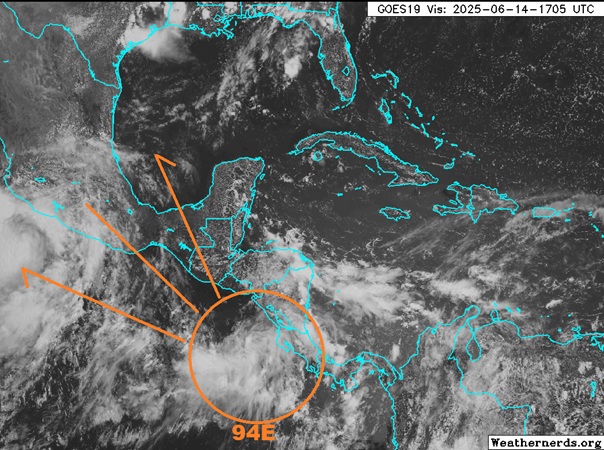
A robust tropical low developing in the extreme Eastern Pacific is poised to become next named tropical cyclone in that basin. Models have frequently, tho not unanimously nor consistently, advertised the potential for development in the southern Bay of Campeche next week and as we have drawn closer to this time frame, it appears that the feature almost all of those models' runs and/or some of their constituent ensemble members' runs have been latching on to, is for what is now Invest 94E in the east Pac and likely to become "Erick," to slide into the extreme western Gulf and/or old Mexico.
The chance for this system to become a named tropical storm in the Atlantic basin (specifically the western Gulf) is still questionable at best, but what is clearly becoming more possible is for an influx of deep tropical moisture and energy from this feature to enter south Texas, many parts of which are already very moist and still recovering from flooding that occurred this week.
Given the increasing chances for significant Texas impacts from either remnants of this presently East Pac tropical low or a bona fide numbered tropical cyclone from its crossover into the Gulf, we are starting a Lounge on this system at this time.
Presently NHC has -0- probabilities up for Atlantic side development within the next 7 days, but this will change if current trends continue.