| cieldumort |
| (Moderator) |
| Tue Jul 15 2025 01:58 AM |

|
|
|
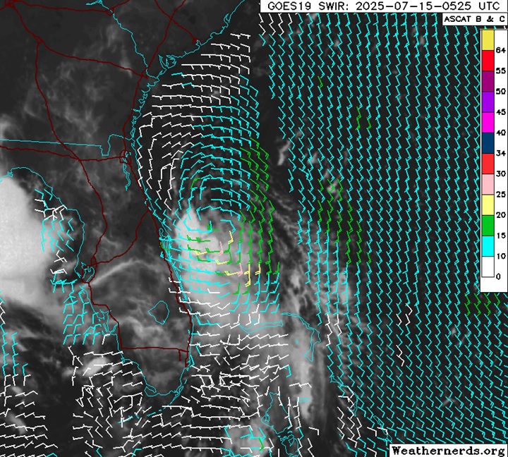
Recent scatterometer data confirms that the circulation of 93L remains elongated.
Deeper convection is still largely shunted to the south and southwest by 15-25 knots of north to northeasterly shear. This shear is largely expected to lessen to under 20 knots with perhaps a window of under 15 knots, if/once 93L enters the northeastern Gulf.
93L's current level of development is about in the middle of what over a dozen different models were showing 36 hours out as to what the system would look like at this time, suggesting that perhaps they have an OK handle on its development, for now.
Interestingly and somewhat perplexingly, 18z and 0z runs have cooled on 93L's development odds. This may be in part owing to a number of models insisting that the main area of vorticity actually comes ashore somewhere around the FL/GA border, with only the southern end of it left to drift into the Gulf. While that scenario seems plausible, there hasn't been any meaningful trend in that direction, so far.