| cieldumort |
| (Moderator) |
| Tue Jul 15 2025 11:09 AM |

|
|
|
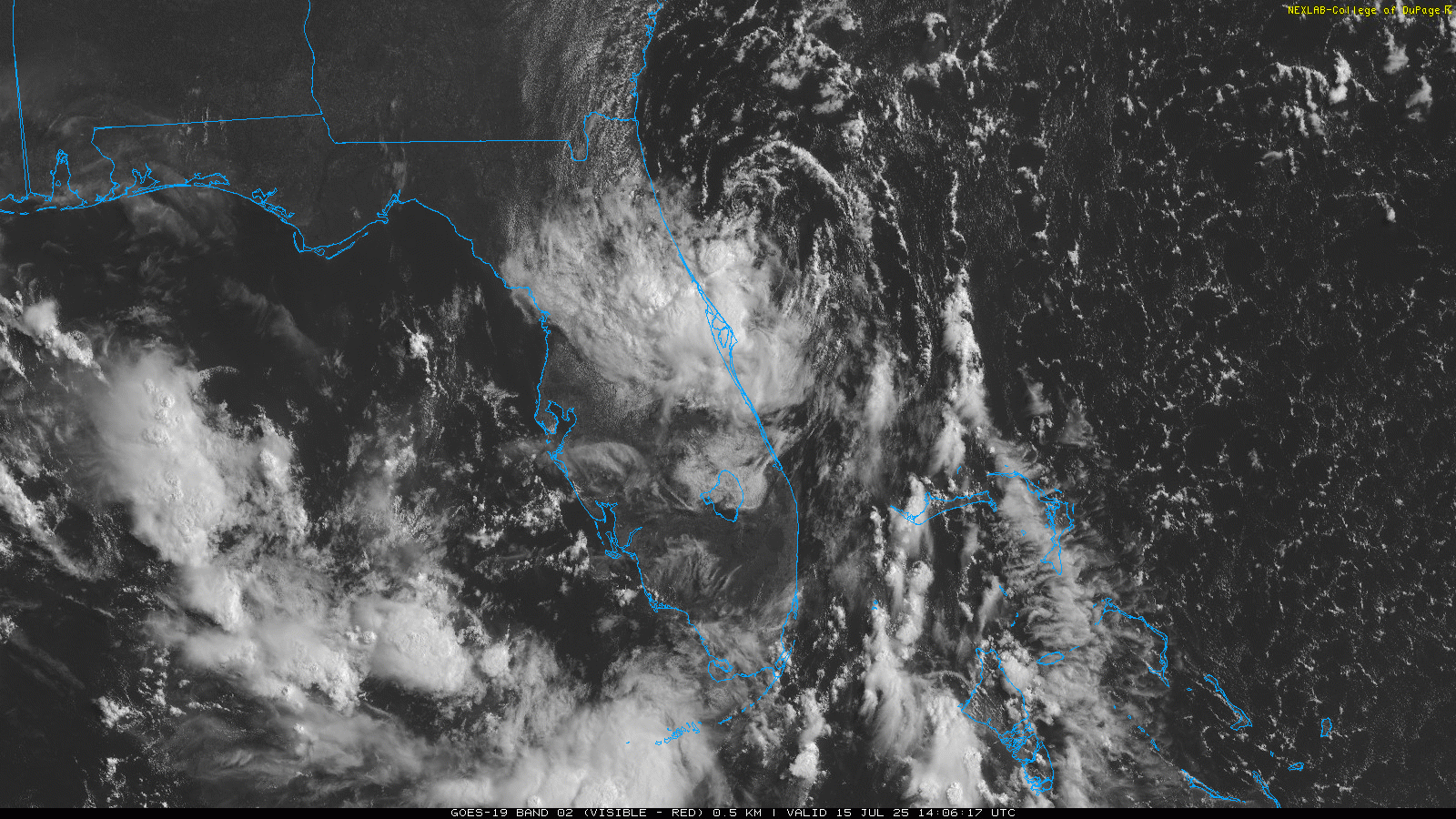
93L has had a well-defined circulation all morning, but showers and thunderstorms remain largely disorganized owing to ongoing bouts of moderate north to northeasterly shear.
The cyclone is now tracking north-northwest as advertised by many recent model runs, roughly parallel to the east coast of Florida, and on this track would make "landfall" somewhere near the FL/GA border, provided it doesn't hook left before then. Considering this track and its now increasingly northerly location, more questions are raised about its ability to reconstitute itself in the Gulf, if/when it ever gets into the Gulf.