| cieldumort |
| (Moderator) |
| Tue Jul 15 2025 01:17 PM |

|
|
|
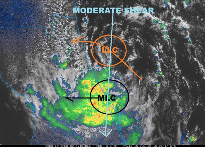
Moderate north-northeasterly wind shear on the order of 15-30 knots continued to plague 93L for too long, preventing the surface circulation from colocating with the mid-level center aloft (up several thousand feet), with the deep convection still only associated with the circulation aloft, and the window for 93L to become a TD prior to crossing Florida has all but closed. There are however suggestions that the mid-level circulation is strong enough to either pull in the surface low, eventually, or perhaps form a new one. This would be the possible scenario outlined for development once in the northern Gulf later this week.
Regardless of classification, 93L is a copious rain-maker for much of the state of Florida, and later this week could become a very serious flood threat for south-central states.