| cieldumort |
| (Moderator) |
| Tue Jul 15 2025 01:44 PM |

|
|
|
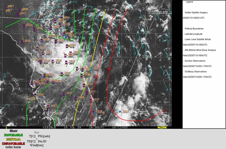
Above: 93L analysis cr. CIMSS
An analysis of the very last few visible satellite and radar frames, along with land and ocean-based weather stations, point to 93L's surface circulation hooking SW, being drawn back in closer to the circulation aloft, as shear, at last, begins relaxing, as can been seen analyzed in the CIMSS 200-850mb Wind Shear Analysis. This could give 93L a better shot out the gate for development once it enters the northern Gulf, which now appears more likely, and provide a much more TD-like feel as it crosses the state.