| cieldumort |
| (Moderator) |
| Thu Jul 24 2025 06:07 PM |

|
|
|

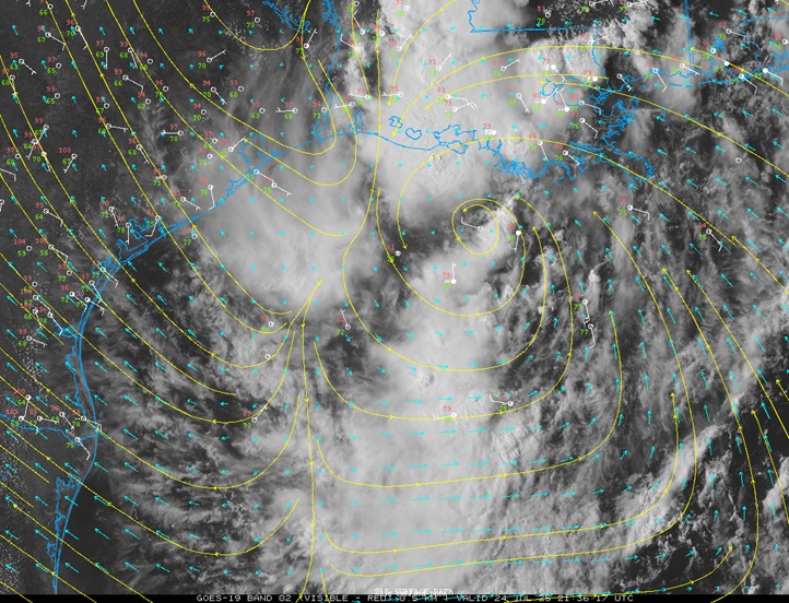
Above: VIS satellite, weather station plots, wind streamlines and vectors from 7/24/25/2146z
Image credit: College of DuPage NEXLAB
A feature now in the north central Gulf, comprised of vorticity along a decaying boundary as well as moisture and some leftover spin from former Invest 93L, looks to be trying to come together considerably south of where 93L tried to pull things off, with more very warm water to work with, and as such, chances for TC genesis appear to be going up and we are likely to have an Invest tagged assigned along with perhaps at least one corresponding recon mission into the system by late afternoon Friday.
Given that this area of low pressure is landlocked, tracking across more of the very warm Gulf waters, tracking through a region of decreasing shear, and will almost certainly produce more heavy rains over portions of Texas and Louisiana that could be sensitive to any additional rainfall, we are starting a Lounge on this Invest TBD at this time, which will probably assigned 95L later tonight or tomorrow morning.