MikeC
|
| (Admin) |
| Sun Aug 03 2025 11:05 AM |
|
|
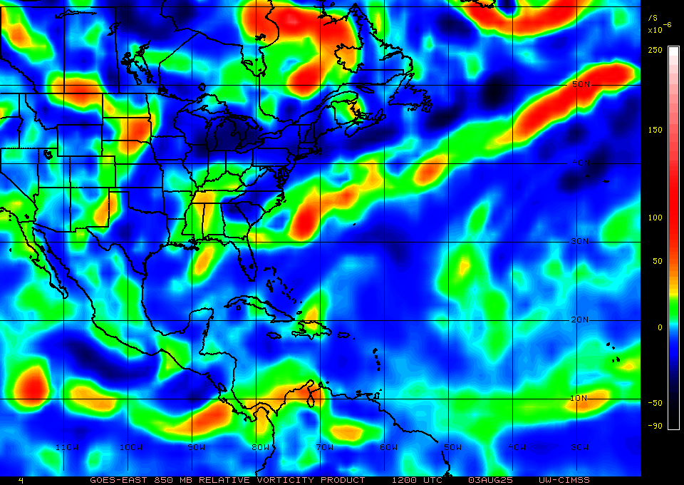
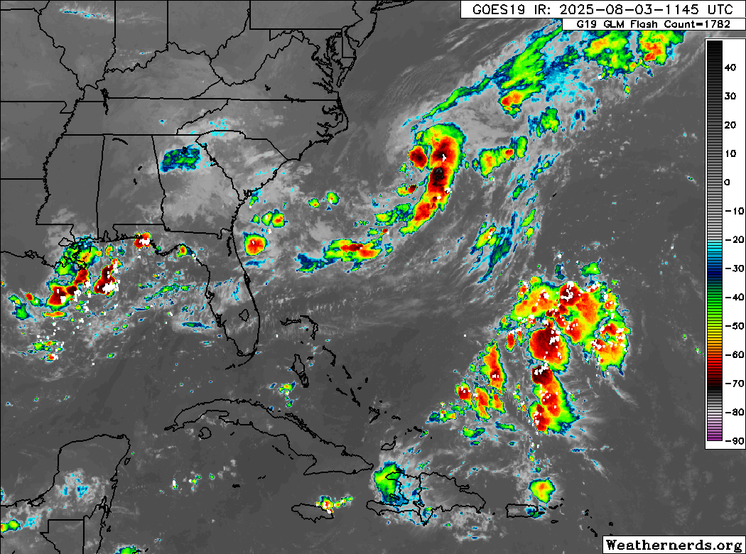
Some interesting this that kinda highlight how mid August may start to get active fast.
95L here on satellite, a frontal boundry over the north gulf, and the old 94L which is the area north of Hispaniola. All somewhat flaring up and showing it probably won't take much to get things going= with relatively short notice sometimes. (I don't expect them to since the Gulf area will move inland, and the 94L area's convection is mostly very far northeast of it, but it does show what to look for)
The area on the southwestern part of 95L (off Jax) is the area that the icon/gfs are keying off of for next development. Icon and GFS want it close to the Outer Banks, but euro keeps it weak and shunts it back into E. Central Florida without development.
95L is also what will likely help pull the 30% area in the east Atlantic out to sea. (I know the GFS has it much further west, but that doesn't seem realistic with the 95l ridge hole)
sat:
matches low level (850) vorticity: