MikeC
|
| (Admin) |
| Fri Aug 08 2025 06:50 AM |
|
|
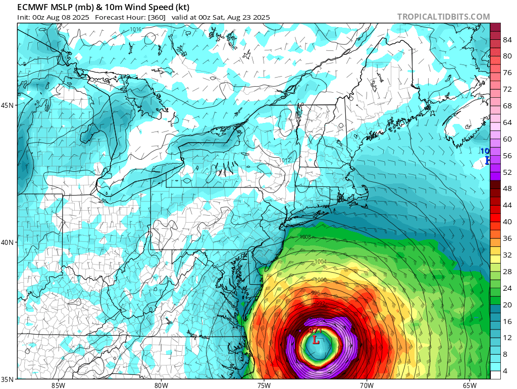
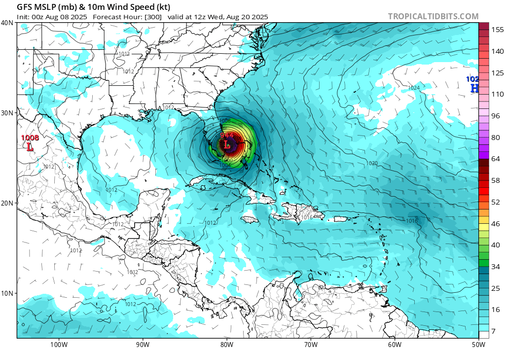
Overnight runs, except for the Canadian, miss the Caribbean Islands. The Euro now recurves the system before the southeast, but threatens new England. The 0z GFS has a south Florida then gulf then Destin hit. There's a long track system coming, although probably days before anything develops so the door is pretty wide open. Any land impacts are 10-15 days out, assuming it doesn't curve before then.
The 6z GFS makes no us landfall at all, but gets very close to the Outer Banks and Cape Cod / Martha's Vineyard (brushes by) as well as brushes Nova Scotia. The notable thing about the 6z gfs is how long it keeps 96L around as a hurricane, which seems to impact the waves track.
One notable thing about the 6z run this morning it stalls 96L in the central atlantic for days.
Something to watch closely over the next two weeks, but nothing definitive or overly concerning now, The current model run set don't even really develop anything for another week, where prior ones did around tue-wed of next week.
last frame of 0z euro
0z gfs
 =
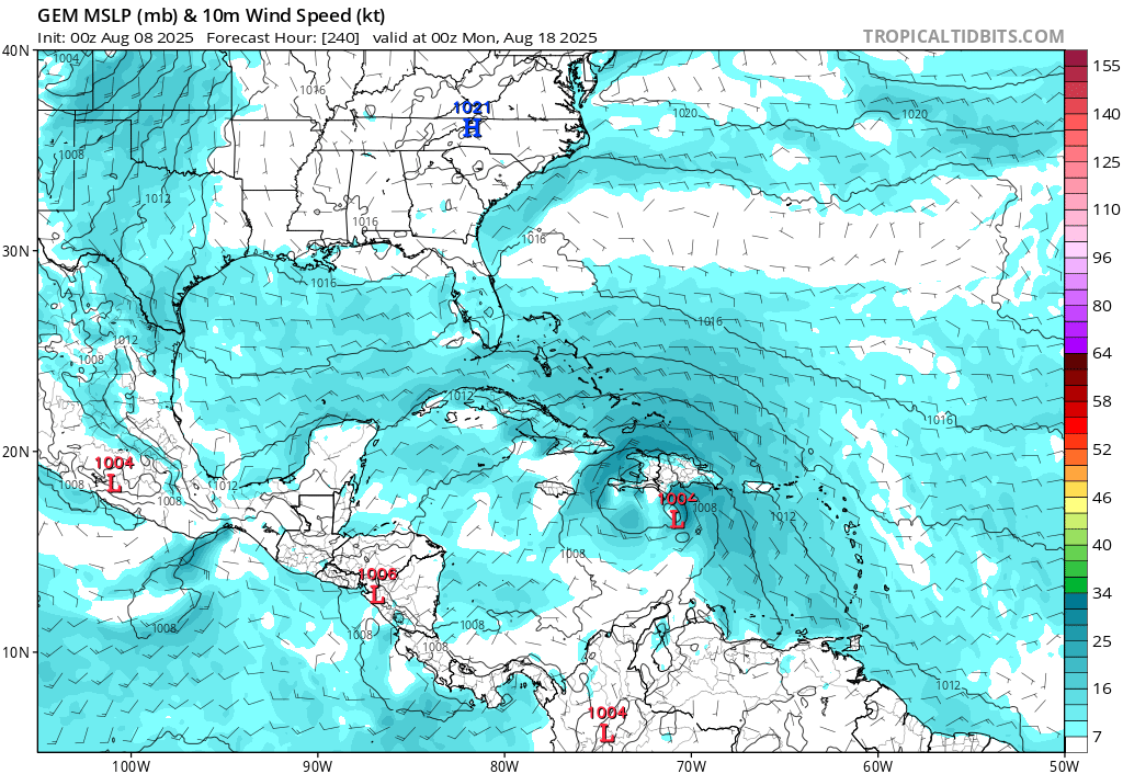
=0z canadain (Weak south of Hispaniola)
euro ensemble spread
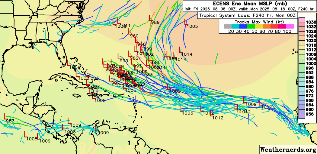
In short no guarantee for land impacts, but enough to monitor it for a while. Ensembles + Climatology shifts the odds to very slightly favor no landfall right now.