| cieldumort |
| (Moderator) |
| Mon Aug 11 2025 04:48 PM |

|
|
|

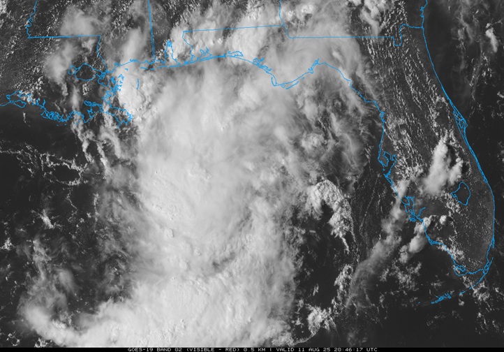
Above: NE Gulf Low Visible 8/11/25/2046z
An area of low pressure off the west coast of Florida we have been paying attention to has consolidated more, and as of this morning had become a somewhat well-defined low with winds up to gale-force in spots. While not yet Invest tagged, NHC did add it to their 2PM TWO this afternoon with a "Near Zero" odds of development.
It appears that operational models haven't been handling this system very well. ECMWF ensembles OTOH have been suggesting something like a 33-45% chance of it becoming a TD early this week before coming ashore in north Florida.
Given the markedly improved structure today and the fact that it is already producing some serious flooding inland, we are starting a Lounge on this feature regardless of whether it is Invest tagged or not.
Interests in the northeast Gulf may want to pay closer attention given the pockets of strong wind and very heavy thunderstorms, and those along the coast and inland may want to have a ready source of weather watches and warnings given how much rain has already fallen and could continue to fall so long as this low is in the region.