| cieldumort |
| (Moderator) |
| Mon Aug 18 2025 03:36 PM |

|
|
|
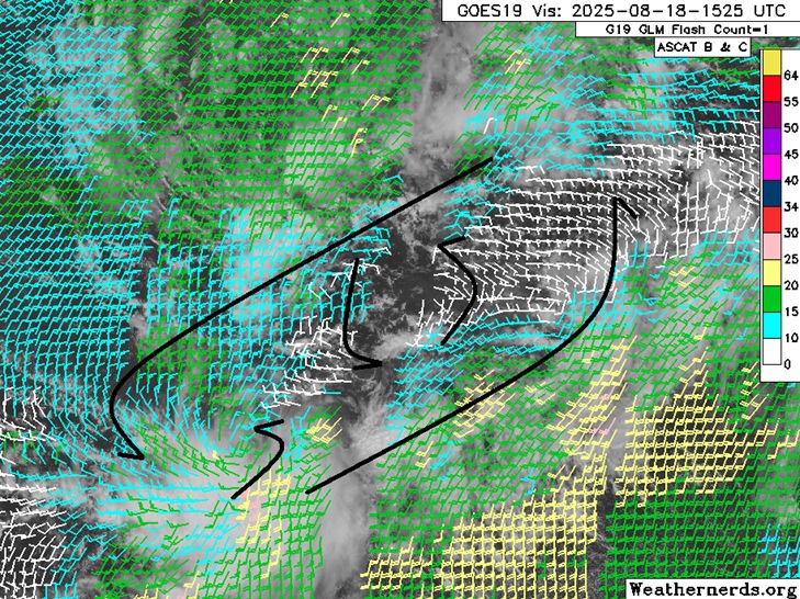
A broad area of low pressure is now taking shape in the eastern Atlantic, comprised of a tropical wave with the axis centered near 32W 12N interacting with a now rolling up of the monsoon trof in response. Two significant areas of spin are evident in conventional radar as well as winds at the surface, as can be seen from the screenshot above (Cr. Weathernerds.com) from 1525z today, with the dominant feature being the wave in the middle.
Given its size and the less than ideal conditions for development over the next few days, odds favor delayed development and thus a further westward track, vs. early development with a greater chance of heading out to sea.