| cieldumort |
| (Moderator) |
| Tue Aug 19 2025 06:17 AM |

|
|
|
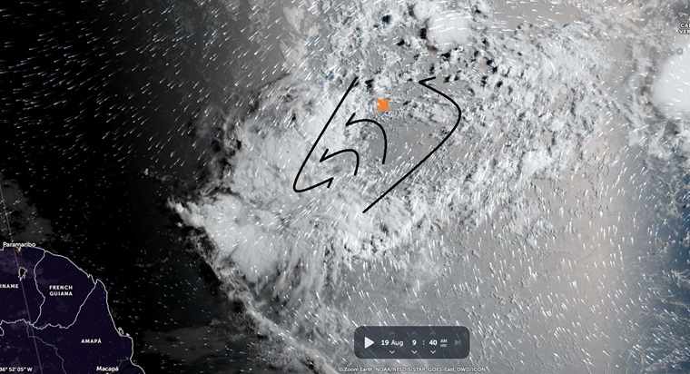
Above: IR Satellite and wind data. Map cr: Zoom Earth 8/19/25/940z
Satellite imagery and model-assisted wind data strongly suggest that a CoC is forming in the southern lobe, well to the southwest of where NHC is tracking this feature (Denoted by the orange "X").
Overnight, a more robust and possibly now dominant circulation looks to have taken shape in association with the deep convection well to "X"'s southwest. Should this trend continue, a substantial relocating of this disturbance would be forthcoming along with likely an Invest tag. Development in the southern lobe portion of the broad monsoonal trof would have significant implications for track, potentially putting the Caribbean islands much more in play.