| cieldumort |
| (Moderator) |
| Tue Aug 26 2025 04:29 AM |

|
|
|
Continuing to keep tabs on what is now (x)99L.
The disturbance formerly tracked as Invest 99L began re-firing convection overnight Monday, taking advantage of both the improved nighttime instability over the warm ocean, as well as moderately divergent winds aloft. This has given what was the shell of a vort left in the wake of devastatingly strong shear some footing.
As this wave has consistently been underbid by models all across the Atlantic, there is impetus for discounting their handle and forecast of the feature, and while NHC is down at 0%, I have been and remain convinced that upon reaching the northwestern Caribbean this could be going right back up along with a "greenballing" of the 99L tag. I'd put the odds of the Invest tag getting resurrected at about 40% within 5 days, and should the disturbance indeed be developed enough once again for an Invest tag, a look at conditions that lay ahead suggest that there would also be about a 33% chance of TC genesis somewhere around the Yucatan, in the Gulf, or in the far eastern Pacific (which if Pacific, it's no longer a threat around here).
These are just some thoughts and are not supported by models, but as mentioned, neither was 99L's ability to keep on going and going and going all across the Atlantic. By most models' runs, it was never to make it to the Caribbean in the first place.

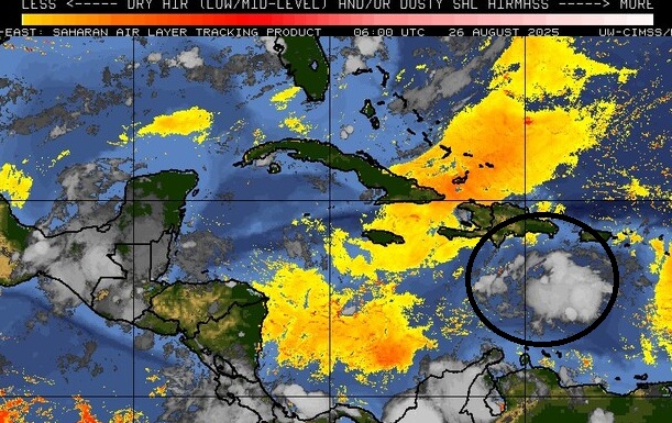
Above: x99L (circled in black) remains cocooned off from nearby dry air ("SAL") that is furthermore easing up in the W ATL

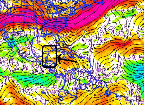
Above: GFS 200-800mb zonal shear forecast from 26/0z valid for 8/29/0z with a rectangle black box over an approximate range of where x99 could be located then. White would be neutral for development and this would make the NW Carib the "sweet spot."

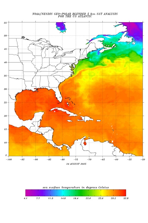
Above: SSTs in the NW Carib and Gulf are exceptionally warm, far warmer than anything 99L had to attempt to avail itself heading across the Tropical Atlantic.