MikeC
|
| (Admin) |
| Fri Sep 05 2025 06:20 AM |
|
|
Competing vortexes and the TUTT are a massive dampening feature on 91L, I..e the possibility is there that it never develops before (or potentially after) the islands. Which needs to be pointed out, especially with ensembles starting to drop out, and the overnight euro not developing it at all. The area southwest of 91L is part of that, but the overal conditions and dry air around it make development not a guarantee. However the islands needs to monitor and hope the weaker trends continue.
The Mid Levels and low levels are not aligned, and not sure there's much at the low levels right now (similar to how 99L never really consolidated). It'll be a while before recon is able to get in there, so it'll just be satellite monitoring now. Until the mid level area southwest quits moving along with it it probably won't be able to accomplish that at all the levels it needs and won't develop.
So it's a bit of a wait and see. There's a pretty high bar for it to develop, and it's not there right now. Models are going to vary a lot until some of this is settled, but I'd bet against it developing until it's clear at all levels there's something still not stuck in the monsoonal flow or mixed in with the other area southwest.
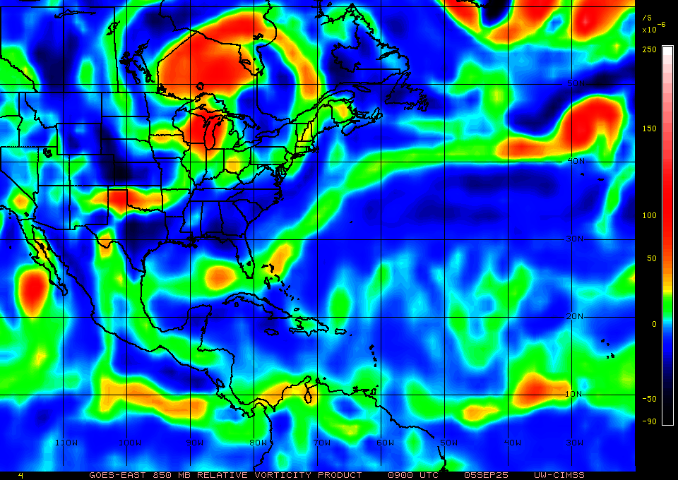
On this chart you see 91L at the 850mb level, and a lobe southwest of it attached to another mid level vorticity, you want to see this detach, or the other area go away before any real development can occur, if it doesn't it'l going to go into the islands weak or as an open wave, as the LLC won't be able to align with either. Even if it does, position of the tutt may weaken it later, it just doesn't have great conditions right now.
Larger WV Satellite shows the issues around it also:
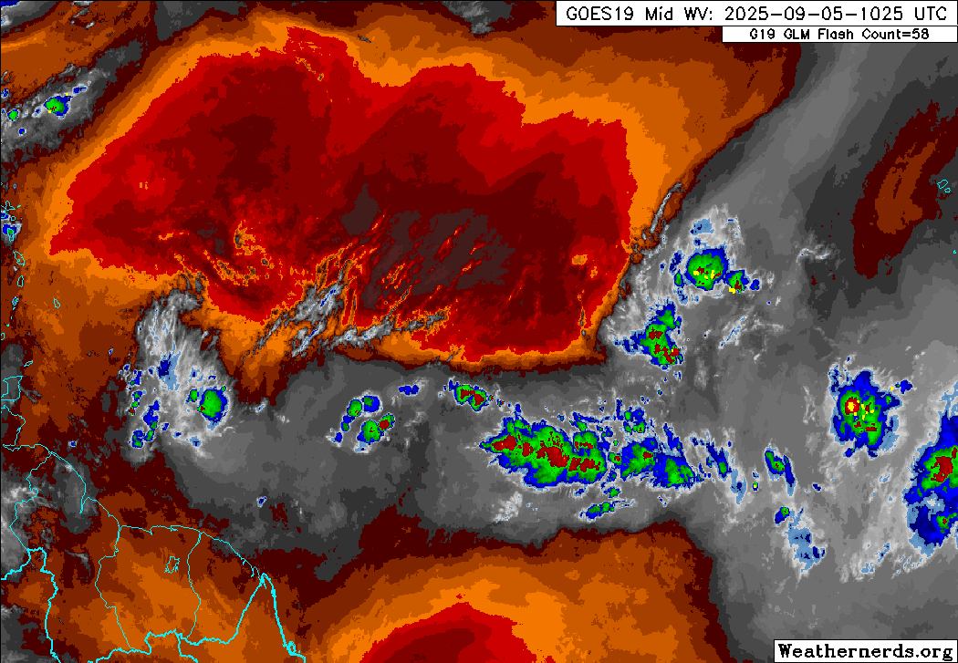
I don't expect development today, and the NHC may drop chances for development later if the mlc issues remain, it's a monitor the satellite/environment over the next day or few time. Still an incredibly difficult setup to determine which way it goes.
Models are all over the map, 6z recurves out to sea after touching the NE caribbean islands, after 0z moved it all the way to Florida through the Caribbean. Ensembles like the google one, only have 1 developing it. GFS ensembles have dropped a lot of support for it, although those tend to go into the Caribbean. Most of Euro ensembles that develop it, also curve it near /over the islands. UKMet does not develop it either.