| cieldumort |
| (Moderator) |
| Mon Sep 22 2025 01:13 PM |

|
|
|
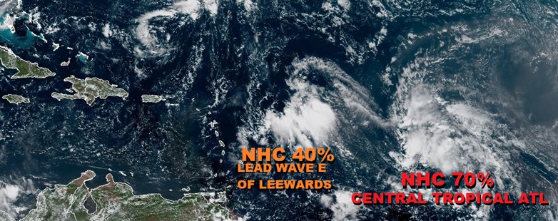
A convectively active wave presently located east of the Leewards has the potential to become a US weather-maker regardless of how developed it does or does not become, and with significant impacts likely to be felt either way, we are now starting a Lounge on this system which will probably be Invest tagged within the next day or two and could go on to get named later this week. Development looks most possible in the southwestern Atlantic or even around the Bahamas, later this week. A lot may have to do with if, and if so, how, it interacts with the wave behind it currently in the Central Tropical Atlantic.
NHC currently giving 40% odds, and this could be a little conservative.
The wave east of the Leewards we have been tracking was Invest tagged overnight, 94L, and the title has been updated accordingly.
2025-09-23 06:00 17.2N 60.7W 25 KTS
94L is NINE with the 5PM Advisory package out on Sep 26 and the title has been updated accordingly.
5:00 PM EDT Fri Sep 26
Location: 20.9°N 74.6°W
Moving: NW at 9 mph
Min pressure: 1008 mb
Max sustained: 35 mph
NINE has become Tropical Storm Imelda on Sunday the 28th, and the title has been updated accordingly
2:00 PM EDT Sun Sep 28
Location: 23.9°N 77.3°W
Moving: N at 7 mph
Min pressure: 998 mb
Max sustained: 40 mph
Ciel