| cieldumort |
| (Moderator) |
| Wed May 27 2026 01:37 AM |

|
|
|
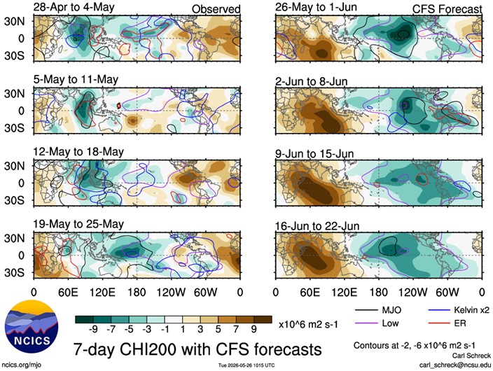
Starting to see more of a model convergence, including the highly-skilled AI models, on an increasing chance for development later next week, around Th/Fr June 4/5 +/-, in the Gulf. Nothing concrete yet, just a stronger signal for potential development. Among operational runs, the GFS, as per usual, is all alone in going gangbusters. There are a few ensemble members of other models that are very bullish, but for now at least, these also remain outliers.
For the early part of the upcoming hurricane season, there should not be much, if any, influence from the forecast developing El Niño. Also, waters in the Caribbean and Gulf are sufficiently warm and an enhanced region of favorable 200hPa velocity potential anomalies, possibly coupled with an MJO pulse, could be in place around this time.
Below: Negative anomalies (Shaded in green/blue) indicate upper-level divergence and rising air.