| cieldumort |
| (Moderator) |
| Mon Jun 08 2026 04:15 PM |

|
|
|
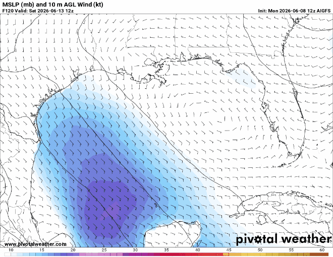
Operational runs of our traditional models, along with their AI versions, are starting to focus on the potential for the Central American Gyre to spill out a vort lobe ~ brand- new and/or the remnants of East Pac Boris and/or Chrstina ~ into the Bay of Campeche, later in the current week, and suggest that the lobe could become better defined while in the western Gulf.
This is a very favored mechanism and location for tropical cyclone genesis early in a season, but even so, the setup often results in nothing more than a stretched out area of closed low pressure that at best gets classified as a T.D. Regardless of development, it could potentially bring additional heavy rains to portions of Texas that are already experiencing some isolated to scattered flooding and are susceptible. Additionally, longer-range runs of ensembles ~ sometimes inc a couple of the excellent Google DeepMind ensembles ~ do hint at the possibility of the forecast disturbance lingering or drifting back out over the northwestern Gulf and acting as a focus for TC genesis up there heading into next week.
My take this far in advance is that it is probably fair to say that the western Gulf has a 15% chance of TC development over the next 5-10 days. At this time, this is both too low and/or too far into the future for NHC to introduce a yellow zone. However, the western Gulf remains an area to keep eyes on.