| cieldumort |
| (Moderator) |
| Wed Jun 10 2026 05:15 AM |

|
|
|
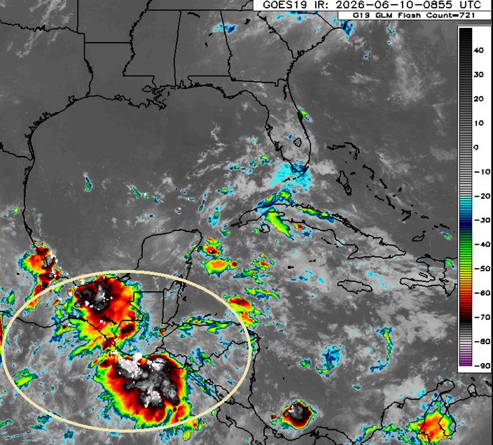
It is looking increasingly probable that a significant increase in precipitable water, and at least some variation of a mostly to completely closed-off lower-level vort, will be drawn into or reform over the western Gulf later this week from DNA remnants of soon-to-be former East Pac Tropical Storm Cristina, leftovers of former East Pac Tropical Storm Boris, and the general weak gyre-like feature associated with the regional monsoon. More and more, models are on alert for this mix to potentially become our first Atlantic Invest of the year - possibly also bringing significantly enhanced rainfall to portions of Texas and Louisiana that may already be susceptible to flooding after recent rains.
Given that models are almost insistent some type of coherent disturbance will track across central America to resurface in the western Gulf over the next 36-84 hours, we will start a Lounge on this forecast weather-maker (Invest unknown/tbd) at this time.
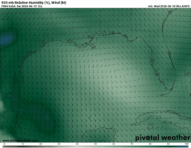
Below: Globals 925mb winds and relative humidity at 84 hours out from 6/10/0z Cr. Pivotal Weather
Below: EURO AI Ensemble Run 6/10/0z Cr. Weathernerds.org
Below: EURO (Traditional) Ensemble Run 6/10/0z Cr. Weathernerds.org
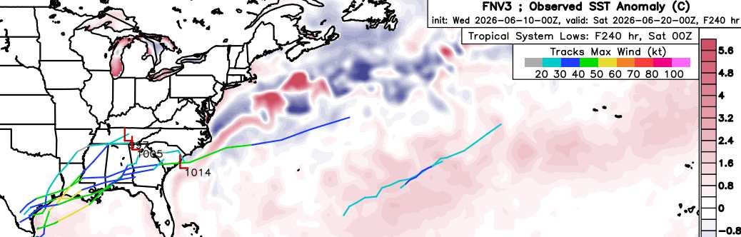
Below: Google DeepMind FNV3 (GDM-FNV3 is DeepMind's newest ensemble probabilistic machine learning weather model, optimized for cyclones) Cr. Weathernerds.org
6-12-26 7:45AM CT: The title has been updated to reflect that the well-advertised Area of Interest is now in the Bay of Campcheche and will likely soon be Invest tagged.
-Ciel
6-15-26 1:35PM CDT: The disturbance we have been tracking for several days has finally been Invest-tagged, 90L, and the title has been updated accordingly
-Ciel
6-16-26 10:00AM CDT: Advisories have begun on Invest 90L, now PTC ONE (Potential Tropical Cyclone), and the title has been updated.
10:00 AM CDT Tue Jun 16
Location: 27.0°N 98.0°W
Moving: NE at 6 mph
Min pressure: 1007 mb
Max sustained: 30 mph
-Ciel
6-17-26 10:00AM CDT: Recon has confirmed that PTC ONE has become Tropical Storm Arthur, and the title has been updated
-Ciel