| cieldumort |
| (Moderator) |
| Sat Jun 13 2026 04:28 AM |

|
|
|
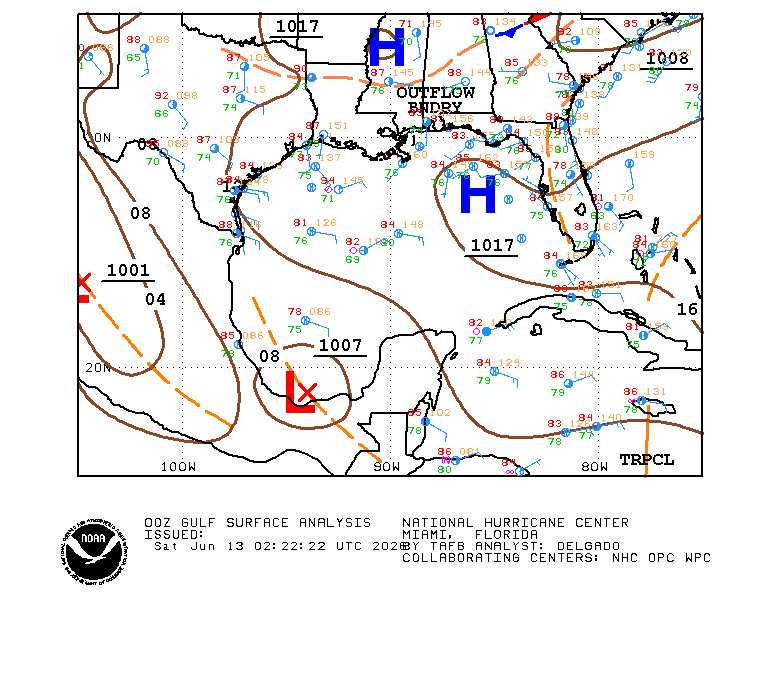
A solid Scat pass arrived a while ago that also suggests a closed surface low exists, but that is wonky and elongated ~ and at the time ~ arguably located partially inland ~ south of the Bay of Campeche. Furthermore, most of the disturbance resembles a trof.
Below: analysis from the Tropical Analysis and Forecast Branch (TAFB) June 13 2:22z
Recent Scatterometer data (surface winds):
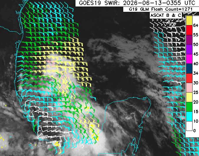
Despite all of the above, the 1007mb Low continues to very gradually show improved convection, moisture and structure, and very importantly, no longer is it getting beaten up by high levels of dry air and shear. Increasingly, the disturbance finds itself in a moistening environment with upper-level high pressure building in aloft, and the fledgling surface circulation could be getting drawn further into the deeper convection to its north.
If trends continue, and Invest tag will likely be added and vort-centric, "Hurricane," model runs could begin.