| cieldumort |
| (Moderator) |
| Thu Aug 13 2026 02:04 AM |

|
 Re: Invest 92L Lounge
|
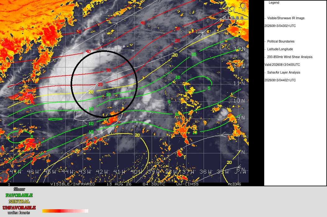
Brutish conditions 92L is running into tonight. The system's center is roughly in the middle of the drawn-in black circle below. The wave is already starting to encounter shear on the
order of 15 to upwards of 35 knots. Along with nearby dry air that occasionally gets drawn in, it's tough going for an MDR wave in August, 2026.
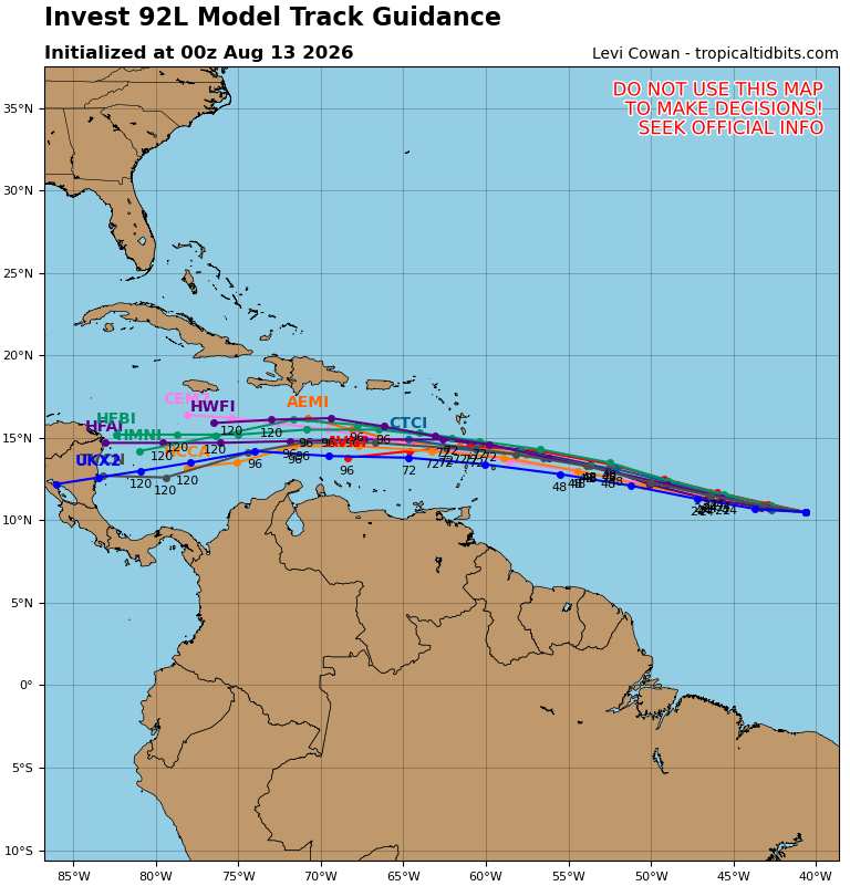
A glance of the 0z globals+hurricane models tonight (image credit: Tropical Tidbits), does showcase that in general,
there seems to be increasing confidence that at least some semblance of a tropical cyclone makes it into and/or even through the Caribbean
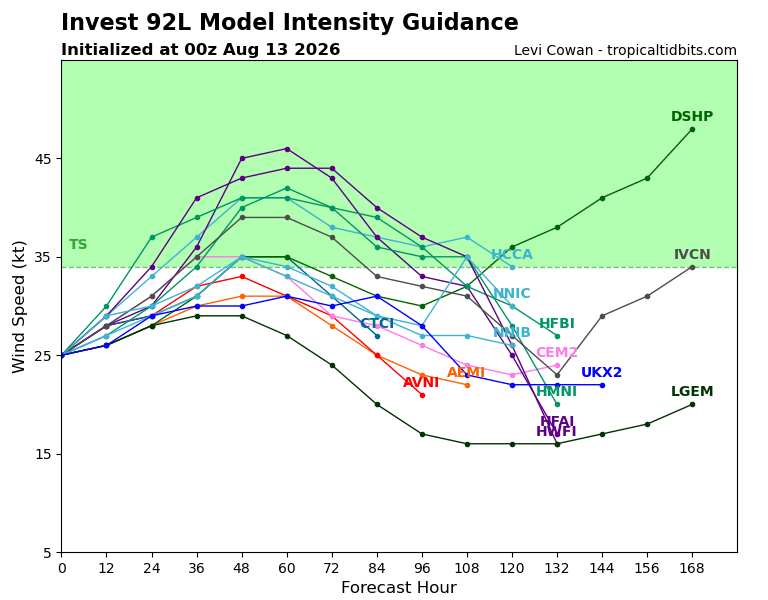
Intensity-wise, most guidance keeps this at best a low-end Tropical Storm throughout