| cieldumort |
| (Moderator) |
| Wed Aug 26 2026 10:04 PM |

|
 Re: 96L Lounge
|
I reckon that 96L is resulting in some debates inside NHC tonight, as well.
My own read of the state of the system is that it is now more likely than not a tropical cyclone or soon will be. Being that 96L is so far out in the Atlantic, we are seriously lacking data. No recon, some quality-flagged if not very incomplete scat passes, etc.
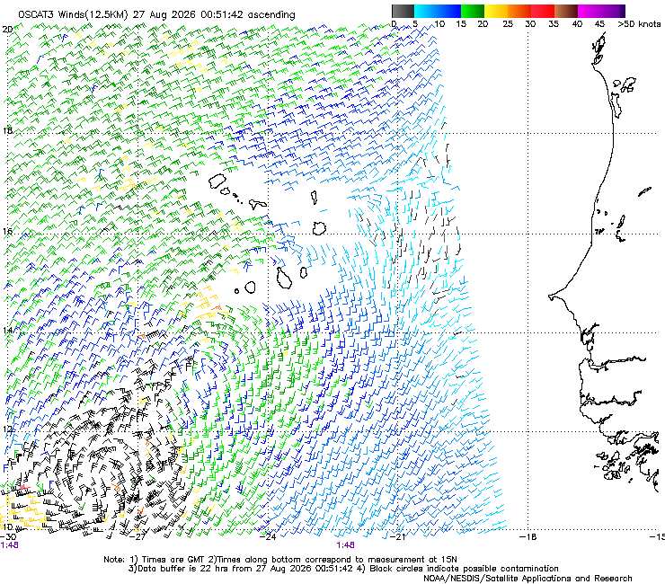
This most recent OSCAT3 pass suggests that it is has a fairly well-defined surface circulation with just remnant troffing extending out towards the northeast. This pass also shows several pockets of tropical storm force wind.
On conventional satellite imagery (visible, IR and pseudo-daylight), the central convection is deep and becoming more concentrated, while there are also spiral banding features extending outward to a significant distance.
I'd place its odds at 90% of becoming Dolly within 48 hours, but I've certainly been wrong before.