| cieldumort |
| (Moderator) |
| Mon Aug 31 2026 10:58 PM |

|
 Re: Edouard Lounge
|
Going to be difficult for Rapid Intensification overnight tonight after ingesting some dry air. Despite this, the most recent pass through Edouard's center by recon noted an eyewall starting to form in the northwest quadrant, which goes to the point that more likely than not, an inner core is still in the process of establishing itself. The center is well south-southeast of the thick band already partially onshore in southern Louisiana.
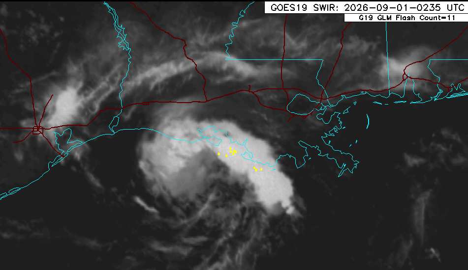
There may be two future opportunities for meaningful intensification. The first, late overnight tonight, provided dry air can get mixed out. The second, heading into and right into landfall, whenever that is. The main reasons for the second opportunity have to do with Edouard moving in to a region of the Gulf coast that encourages cyclonic flow - along with the tightening effects of friction from land. This latter opportunity is most favored by the models and ensembles that do ramp the system up to or or near hurricane status.