| cieldumort |
| (Moderator) |
| Fri Sep 25 2026 01:07 PM |

|
 Re: Modeled Wet Hybrid Cyclone off Mid-Atlantic
|
Models increasingly want to transition this into a full hybrid trending tropical heading into landfall.
The most recent HAFS-A run strongly implies hurricane-force wind gusts, potentially locally at or above 90 MPH, by Saturday afternoon just offshore of New Jersey, New York, Connecticut and Rhode Island. By later Saturday night and into Sunday morning, coastal inundation could become locally pronounced and even dangerous in spots. Wind gusts at or above 60 MPH pushing well inland this time of year with lots of leaves on trees may result in sporadic to widespread fallen branches, shingle loss, etc. Power outages depending on network build, but increasingly a risk.
Not out of the question that this transitions to mostly tropical for a duration. Hurricane-like conditions almost certain in some areas, regardless, per HAFS-A.
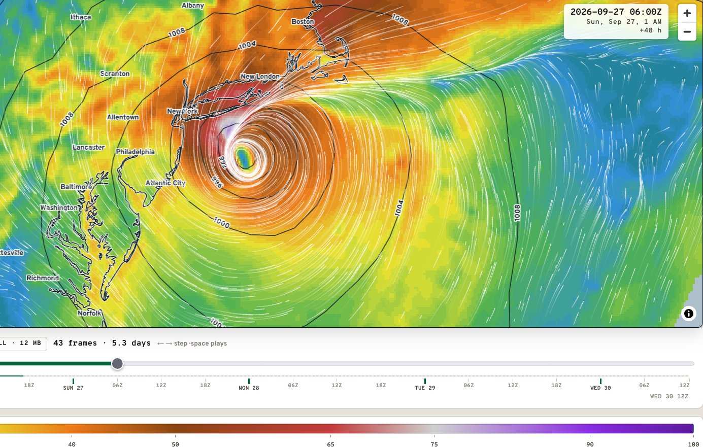
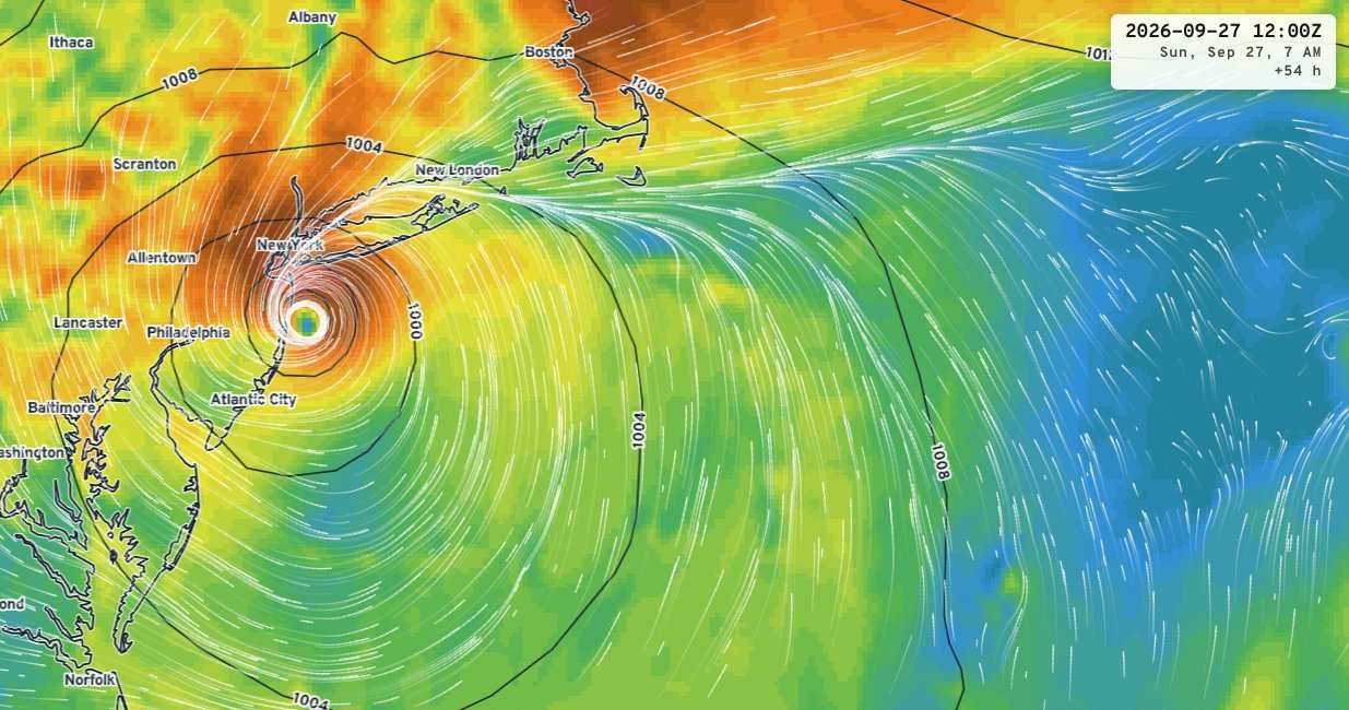
Graphics credit: Ryan Maue/tropics.earth