| cieldumort |
| (Moderator) |
| Sat Oct 03 2026 03:49 AM |

|
 Re: W Carib-Gulf Window Oct 6-14 Invest TBD
|
This is an incredibly tricky season for both models and forecasters alike where the Atlantic basin is concerned. The one safe bet all season would have been, has been, should have been, "Nothing becomes a hurricane." Fay and possibly Edouard got close, but no cigar*. With this backdrop, the rational thing to do is ignore any model runs that ramp up this yet-to-form system in the Gulf beyond 60 MPH unless and until something is getting obvious.
The most recent suite of 0z Globals during this window.
Quick Globals rundown:
EURO - Sloppy Trof; borderline TD at times by 10/11/06z in northern Gulf
EURO AI - Weak Tropical Low by 10/11/0z in northwestern Gulf
GFS - TD or Low-end Trop Storm by 10/12/06z in northwestern Gulf
GFS AI - TD by 10/11/0z in the southwestern Gulf. Quickly makes landfall in western BoC mainland MX.
ICON - Borderline TD by 10/10/06z in the northern Gulf.
UKMET - Apparent TD or weak Trop Storm in the southwestern Gulf by 10/07/21z. Making landfall around Cape San Blas, Gulf County, 10/10/0z 989mb.
As for the Google DeepMind FNv3 ensembles, after a dip with their 18z run, the most recent 0z came back in implying a 30% chance of this becoming a Tropical Storm
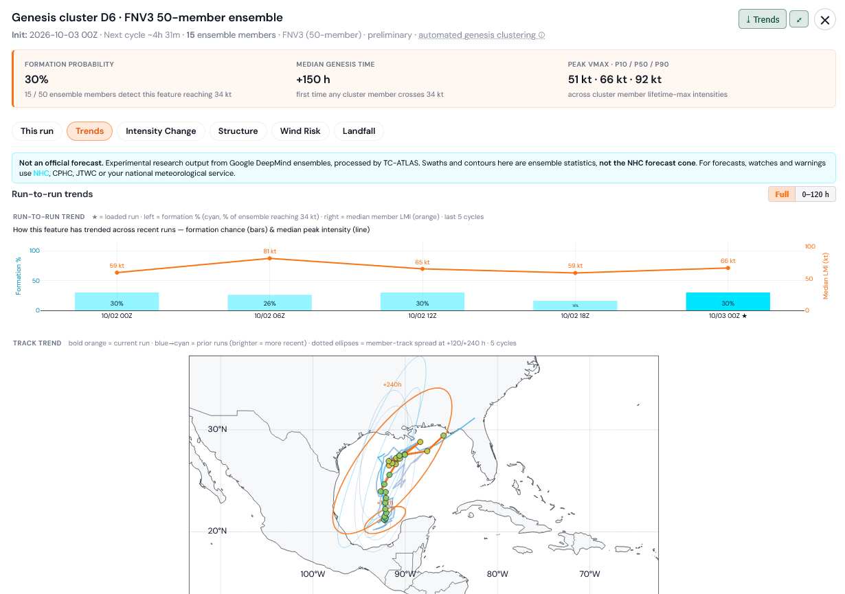
Credits: TC-ATLAS and Google
*Both Fay and Edouard were likely stronger than operational advisories had them and one or both could easily be upgraded during reanalysis. Only referring to real-time NHC Advisories.