| cieldumort |
| (Moderator) |
| Tue Oct 06 2026 11:54 PM |

|
 Re: NINE Lounge
|
Incredible what just 4 days can do to change things. Turns out, then-92L ended up with everything going right for it. To this point, all the stars have aligned. This did not appear at all to be its baseline just a few days ago, and to be candid, I think a number of us, myself included, have been burned one too many times this season by the would-bes that ended up wrecked by high shear (record El Niño), so were also quick to buy in to the more tepid model solutions (of which the vast majority were up until the past 48 hours or so).
Tonight, the stars continue aligning for now NINE (possibly already a tropical storm but we have no recon or recent scatterometer pass inside to confirm). Initially, it looked to models as if the disturbance on the eastern Pacific side of the Isthmus of Tehuantepec would develop first or at least early and strongly. The opposite has occurred. Consequently, higher shear that could have been battering 92L/NINE in its formative stages has been delayed enough so that the now tropical cyclone NINE might find itself with a developing inner core, about to travel across record warm Gulf waters and have divergent outflow to both its north-northeast and southeast, and perhaps even a bona fide outflow channel stretching off to its north-northeast as the entrance region of a developing and approaching subtropical jet streak passes by to NINE's north-northeast.
Models now largely buy into the continued all-stars-aligning scenario and thus many more ramp NINE up into a very significant hurricane.
There are still ways for the upper-bound intensity limits seen in an increasing number of model and ensemble runs to stop from verifying, but the number of ways is decreasing and so increasing the odds of a higher-end cyclone in the Gulf heading towards US land.
Shear is very likely to increase to moderate or even high levels prior to NINE making landfall on the Gulf Coast, but it is increasingly uncertain if shear will be high enough and early enough to induce significant enough degradation and weakening from what could be a beast of a tropical cyclone by Friday, heading towards US land.
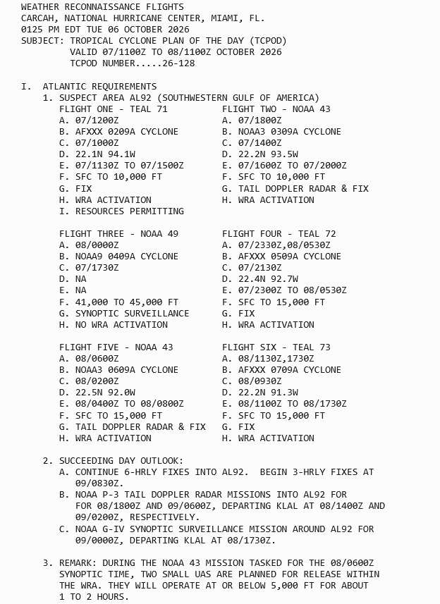
As Mike noted, the high altitude survey data taken today will hopefully greatly improve forecasts that come out over the next few cycles and NHC will have a better handle on all of this. Regular missions begin in earnest Wednesday morning.