| cieldumort |
| (Moderator) |
| Sat Aug 19 2023 09:27 PM |

|
|
|
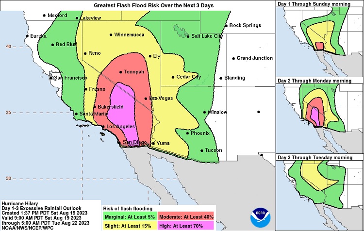
Lift and frontal boundaries/convergence zones courtesy the closed upper-level low off the California coast are conspiring with Hilary to enhance rainfall and strong thunderstorms with damaging wind gusts well ahead of Hilary even crossing into the state.
This pre-soaking may cut both ways, being that on the one hand it will help soften up some ground that may have otherwise lead to rapid runoffs because the ground being unable to absorb water. On the other, some of these rapid runoffs may now occur sooner than later, and at some point grounds will reach a saturated level. The potential for over a foot of rain in some locations, with widespread 1" to 4" occurring over so much other real estate where that is more like a month or two's worth of rain, will easily place portions of California, Arizona, Nevada and destinations yet to come at a severe risk for potentially locally catastrophic flooding.