| cieldumort |
| (Moderator) |
| Fri Aug 14 2026 01:51 AM |

|
 Re: Tropical Storm Lala - Hawaii Threat
|
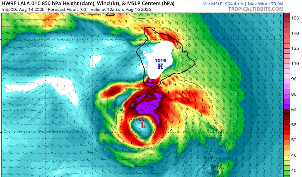
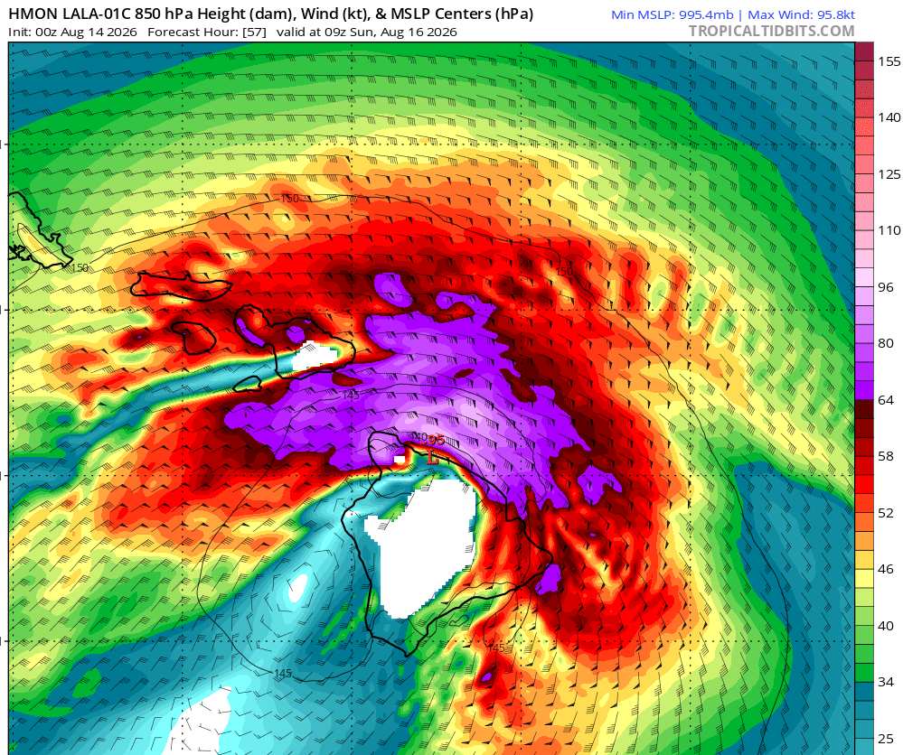
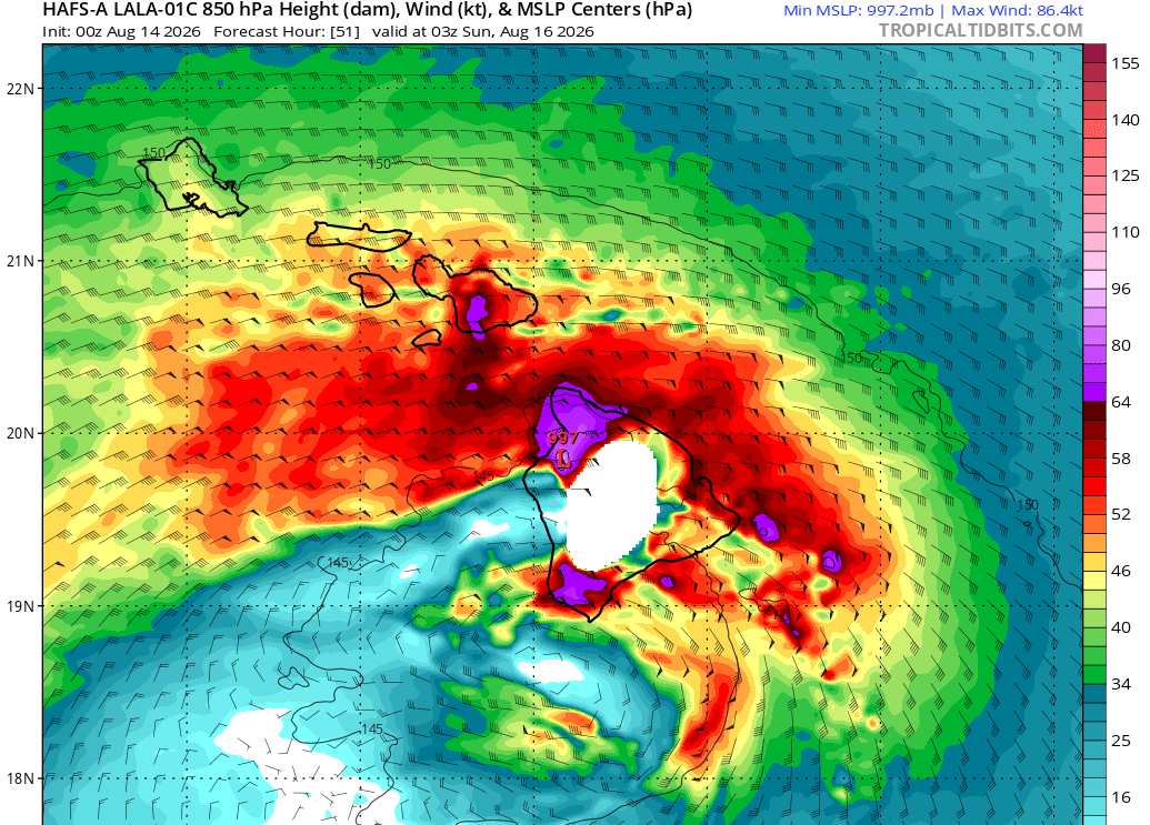
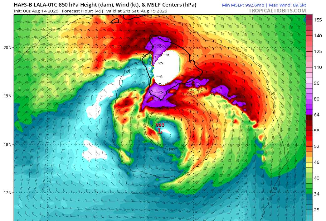
The 8/14/0z runs are coming in and giving us an idea of what the models think maximum sustained winds at an elevation of roughly 5,000 feet (850mb level) will be, which is still well less than half the altitude of the tallest point on the Big Island, at 13,803. Roughly 18% of the Big Island is at or above 5,000, meaning maximum sustained winds of these speeds are expected by these runs over much of the higher terrain of the Big Island.
Some portions of the models leave the island blank (white). This is an artifact of not colorizing the higher terrain, and in no way actually indicates a lack of wind.
This group of hurricane models have had the initial recon missions' data ingested.
HWRF - Max sustained winds at roughly 5,000' elevation of at least 80 MPH within the strongest bands and/or core
HMON - Max sustained winds at roughly 5,000' elevation of at least 110 MPH within the strongest bands and/or core
HAFS-A - Max sustained winds at roughly 5,000' elevation of at least 99 MPH within the strongest bands and/or core
HAFS-B - Max sustained winds at roughly 5,000' elevation of at least 102 MPH within the strongest bands and/or core
Hurricane model screenshots credit and courtesy: Tropical Tidbits