| harmlc.ath.cx |
| (Weather Hobbyist) |
| Tue Jul 18 2006 07:56 PM |

|
|
|
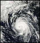
Here's some of the latest recon information
Storm Name: Tropical Storm Beryl
Time: 23:32:40Z
Latitude: 33.8°N
Longitude: 73.4°W
Location: 160 mi SE of Cape Hatteras, North Carolina
Max Winds: 47mph
Sea level pressure: EXTRAP 1006 mb
Flight ID: AF308
Observation Number: 25
Distance and bearing from center to max surface wind: 33 mi E (101°)
Maximum flight level wind: SSE (148°) @ 52 mph
Distance and bearing from center to max flight level wind: 20 mi ENE (71°)
Max flight level temperature outside the eye: 70°F at 863 feet
Max flight level temperature inside the eye: 73°F at 689 feet
Dewpoint temperature inside the eye: 70°F